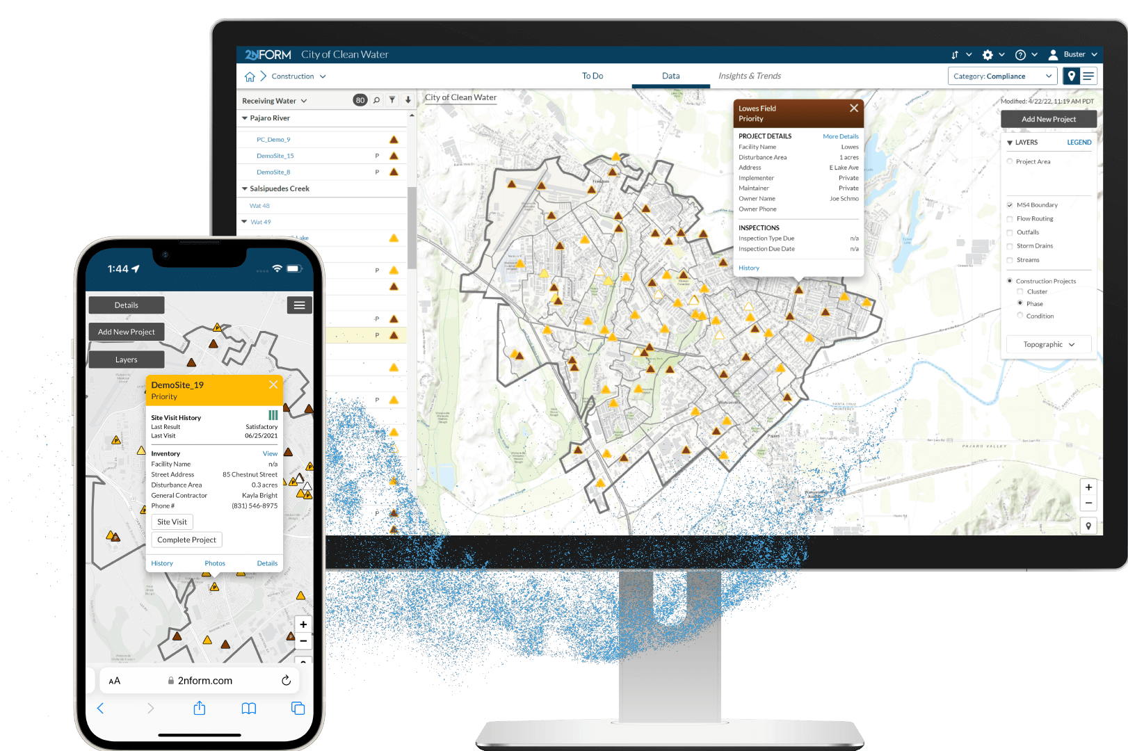
See all current construction projects — and past ones
Compile and manage a geospatial registry of all active and completed construction projects including documentation, inspection, and enforcement records.
Inspectors & contractors appreciate standardized forms
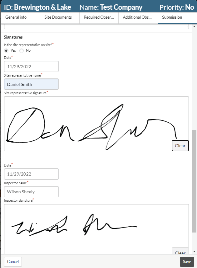
Comprehensive construction site runoff inspection protocols — built and improved with input from hundreds of inspectors, contractors, and program managers.
Collaborate with ease, online
Add the Collaboration Portal to enable contractors to review and respond to enforcements via the web, reducing both staff time and the risk of incomplete compliance documentation.
Keep up with the fast pace of construction sites
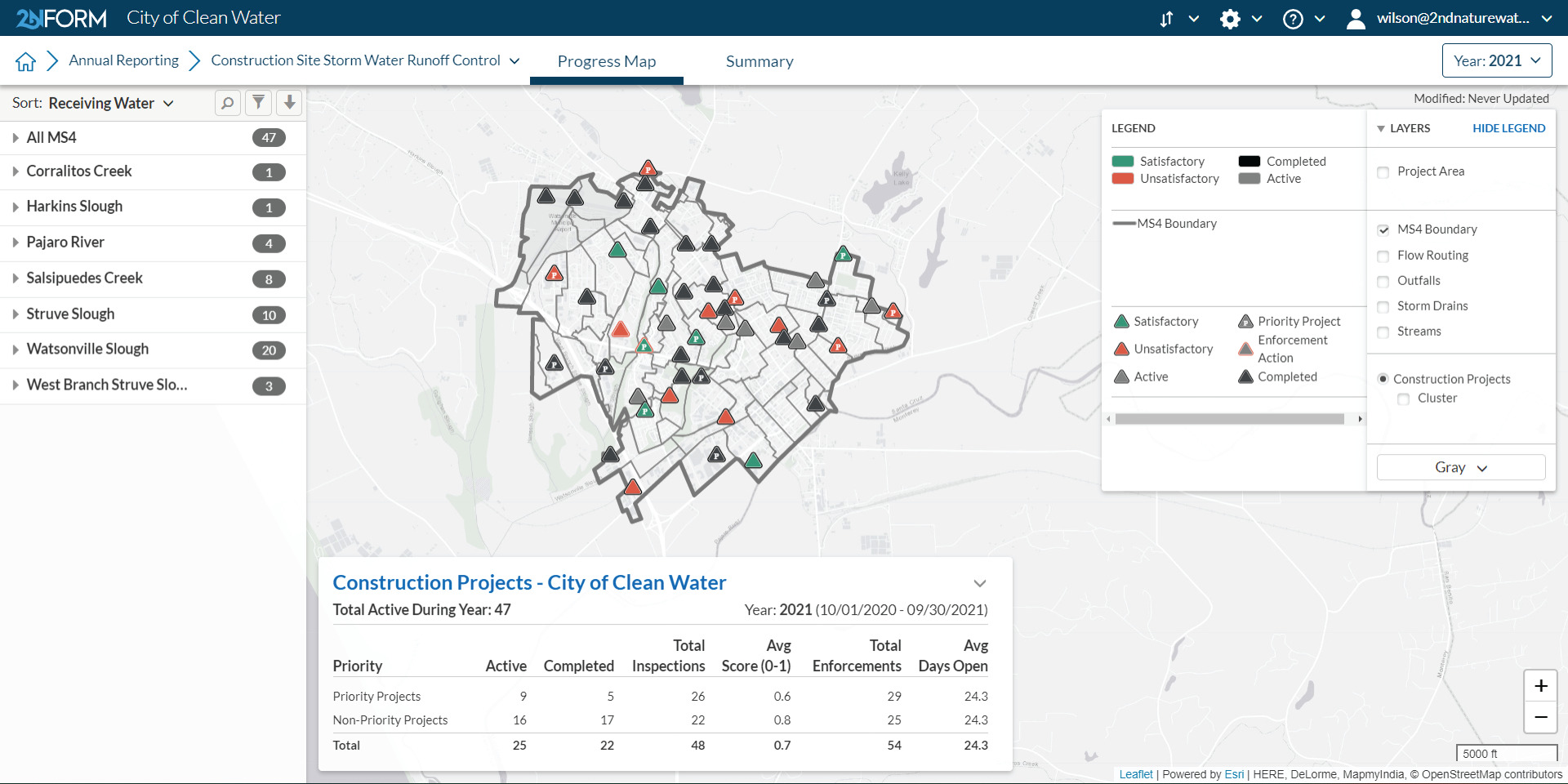
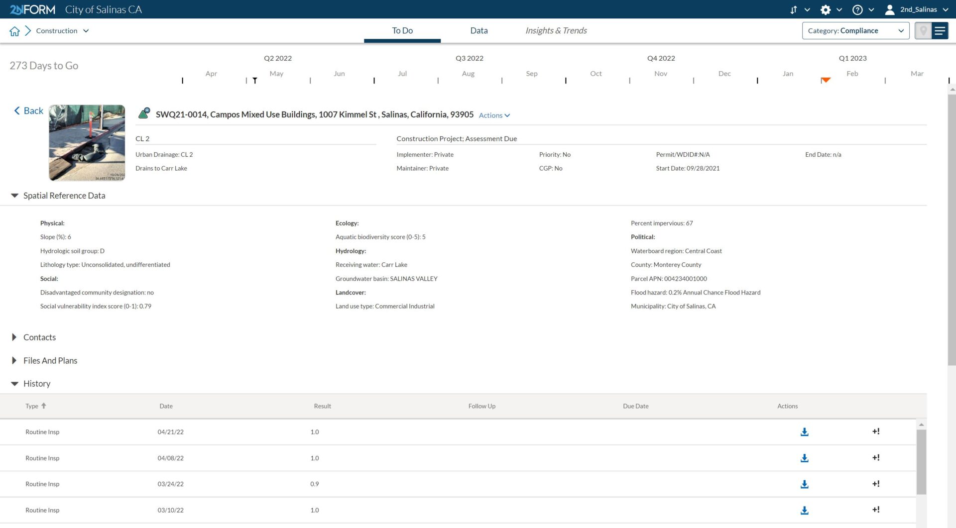
Make sure you have all the information you need
Construction sites are notoriously difficult to keep track of, because they change so fast. Inspectors, especially third party contractors, may be slow at turning in reports, or leave out important information.
Proven, standardized inspection protocols ensure that you get all the information you need about how construction sites are preventing pollution runoff.
Users can add photos onsite to create a visual record of problems or solutions.

If our regulatory agency wants to know how many construction projects we have, where they’re located and the inspection and enforcement history, it’s easy to show them.”
Jean loves how 2NFORM is revolutionizing their construction site inspections — and helping them plan for the future, using built-in predictive analytics.
Read the case study
Built-in capabilities
Streamlined compliance reporting

Intuitive problem solving with GIS

Data-driven insights and trends

Smartphones, not clipboards

Schedule and track work
Streamlined compliance reporting
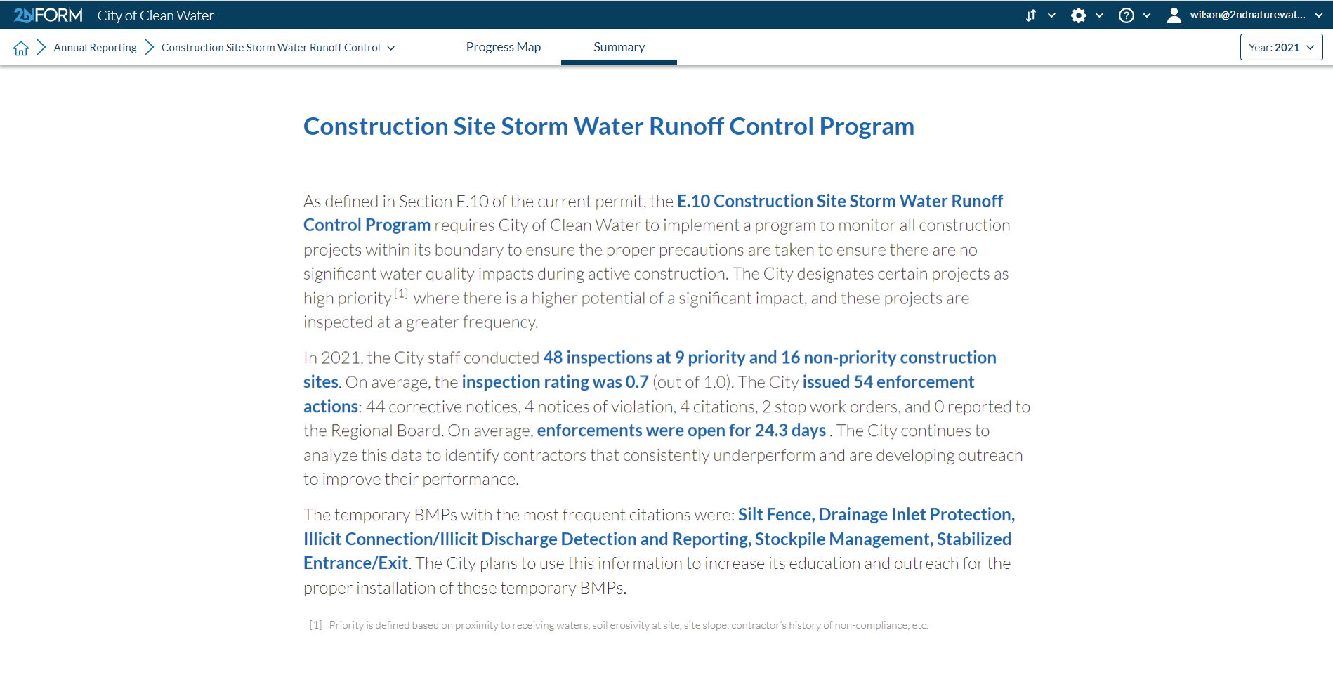
2NFORM streamlines the compilation of your MS4 annual report by summarizing the data your team has collected throughout the year into the relevant section of your permit. The software generates maps, tables and concise narratives populated with program details to summarize program progress and clean water impact of your program efforts.
2NFORM allows you to spend more time on strategic stormwater management and less time reporting to your regulator.

More 2NFORM Modules you may like

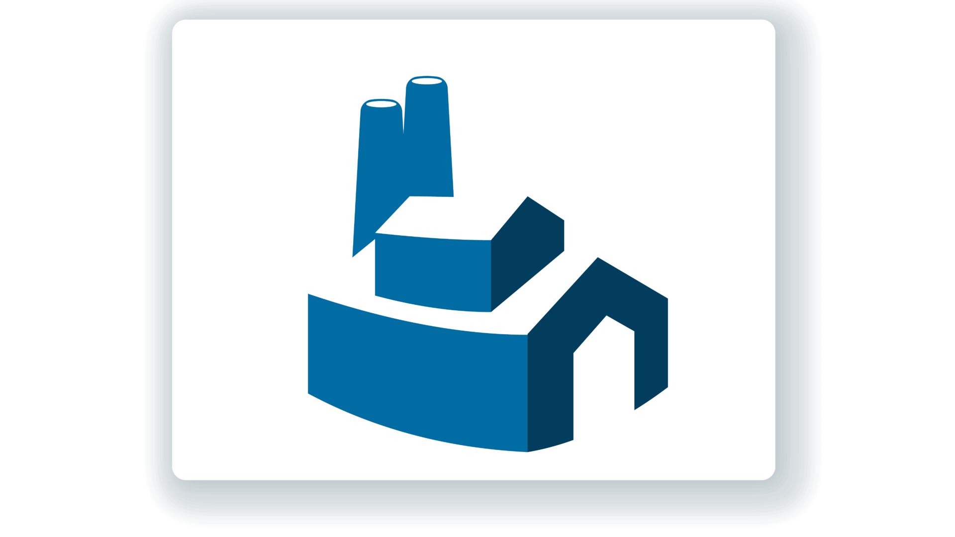
Industrial/ Commercial Module
Inspect, verify, enforce industrial and commercial facility compliance
View module

Let us help you map a better way
Book a personalized demo to see how our products provide the visibility you need to streamline compliance, achieve your goals, and focus your energy on clean waterways.