
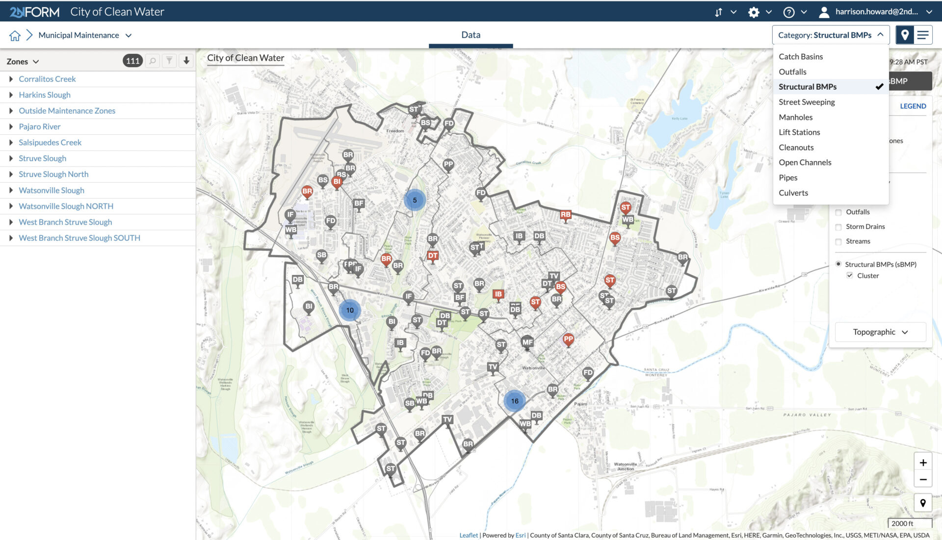
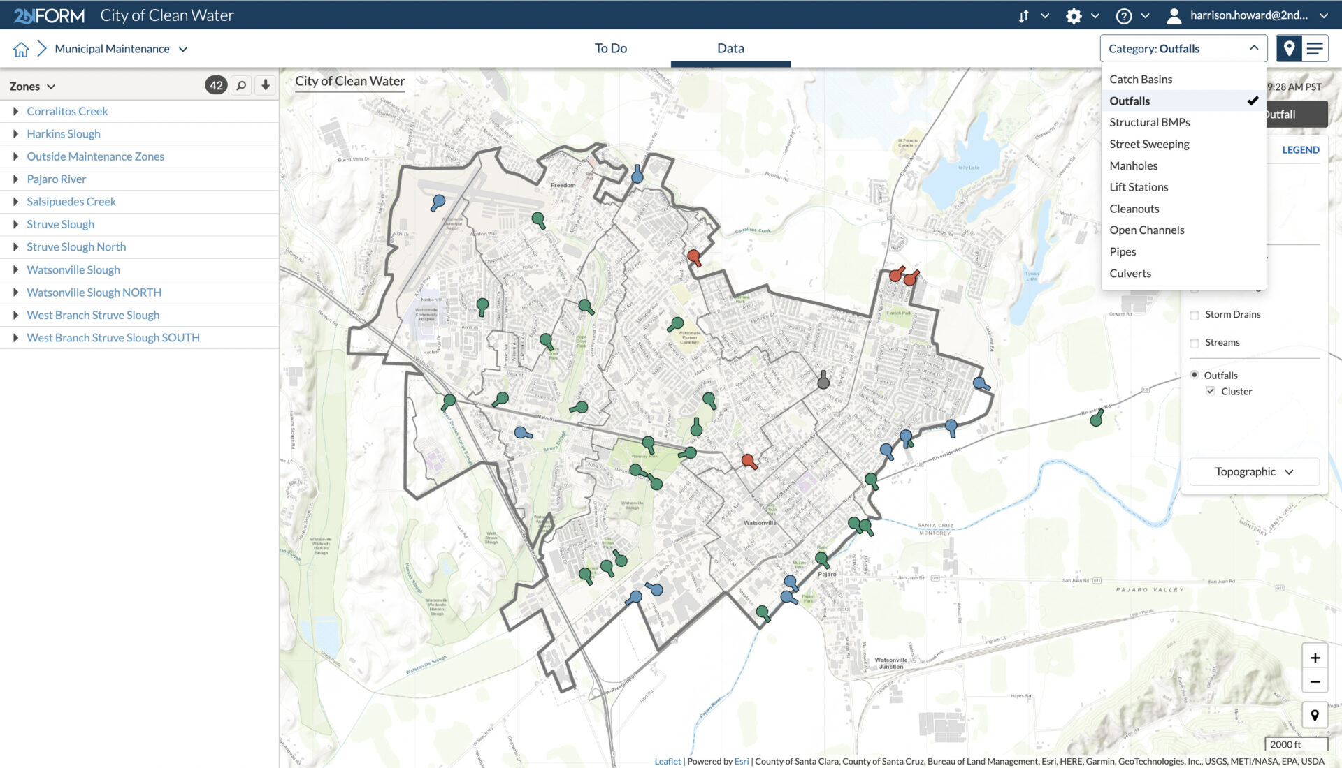
Map your assets
Efficiently map and catalog public assets, as required by your MS4 permit.
Organize your work
Automated to-do lists help your team prioritize inspection and maintenance tasks.
Capture the right data
Intuitive forms are accessible from anywhere and ensure that field staff collect the required data every time.
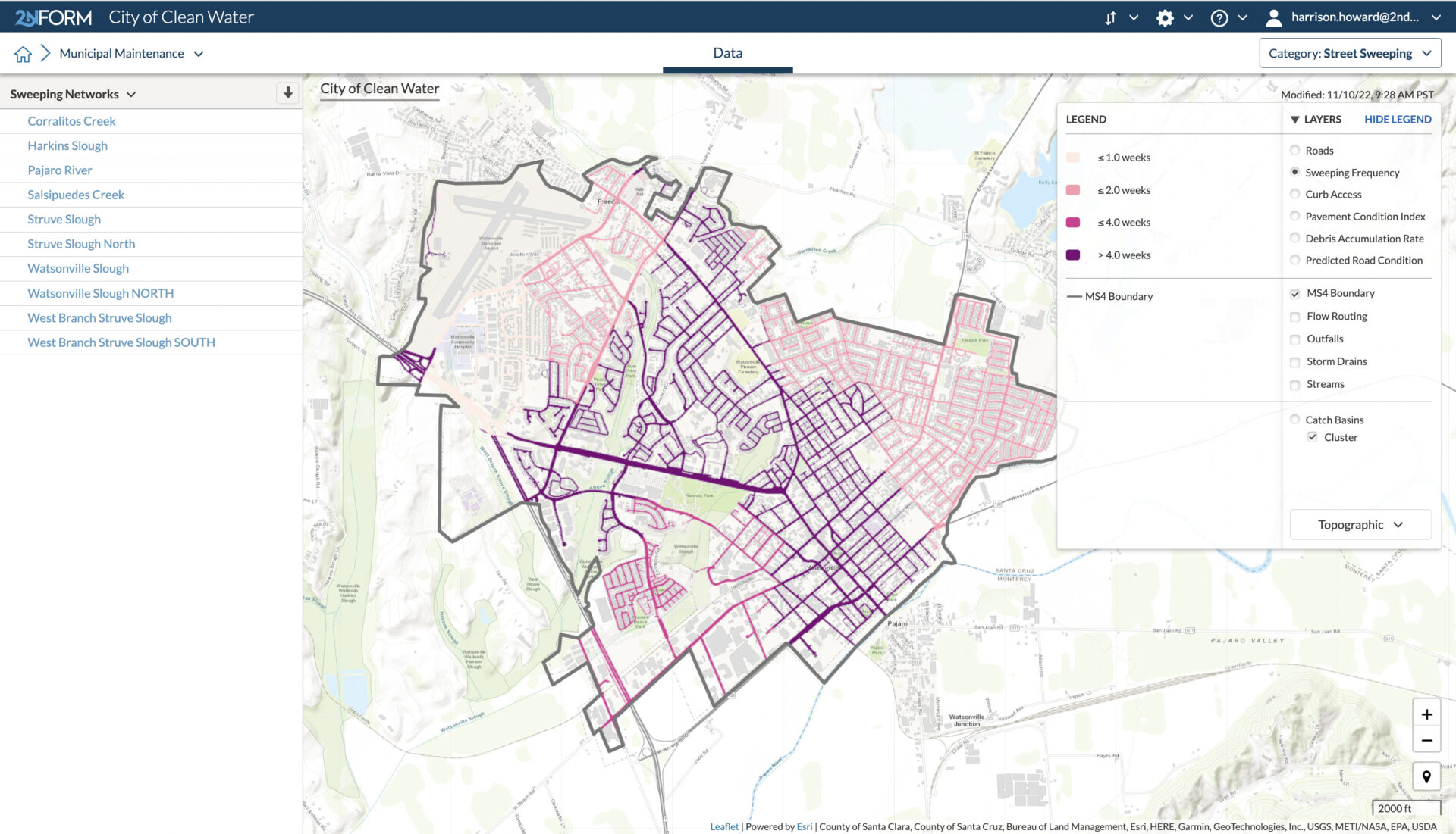
Align maintenance priorities
Data-driven insights help you allocate resources where they are needed most.
Reduce risk of flooding
Use analytics to anticipate and prevent flooding.
Get pollution reduction credit
Demonstrate the connection between activities and pollutant removal
Manage your four fundamental requirements
Organize your inspections and maintenance activities
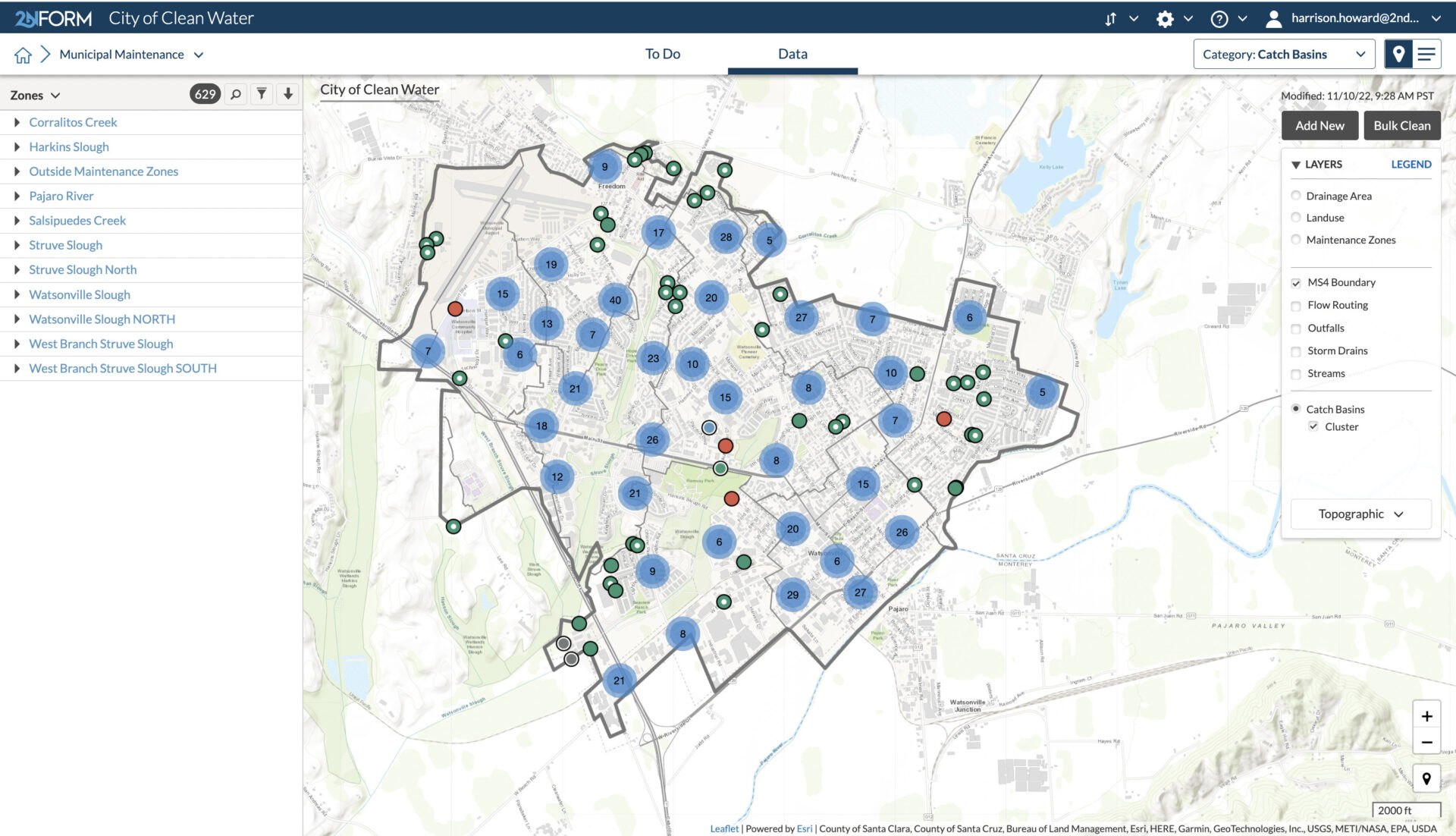
Catch Basins
Performing routine inspections and necessary maintenance is essential to keep catch basins operating effectively. 2NFORM helps you plan and track those activities.
The intuitive map shows you the location and status of each catch basin. That map automatically updates each time your field crews inspect or do maintenance. You’ll always have the best information available at your fingertips. With 2NFORM’s integrated reporting capabilities, you’ll have the data you need to submit with just a few clicks.
Built-in capabilities

Streamlined compliance reporting

Mapping & GIS features

Data-driven insights and trends

Smartphones, not clipboards

Schedule and track work
Streamlined compliance reporting
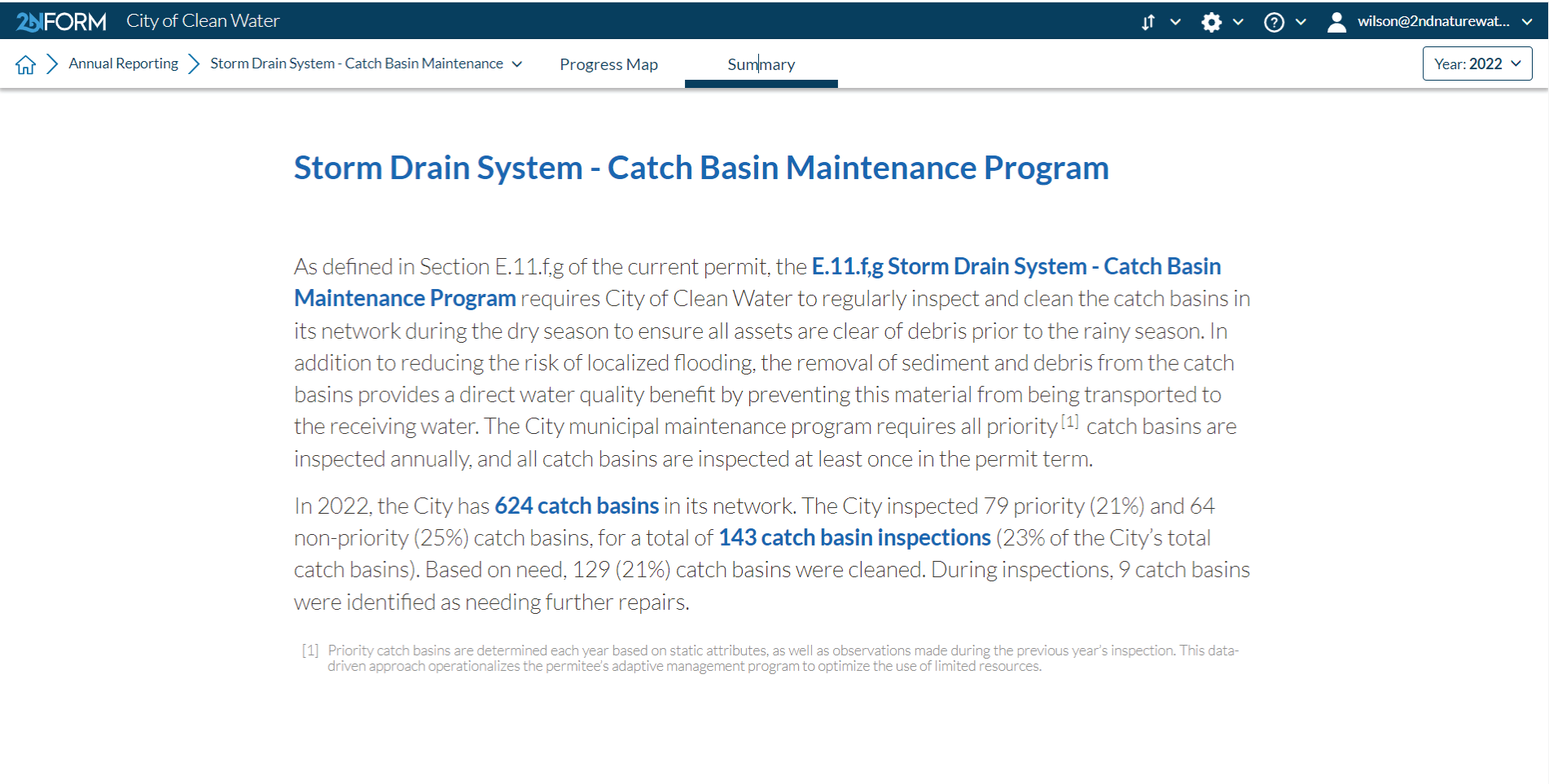
2NFORM streamlines the compilation of your MS4 annual report by summarizing the data your team has collected throughout the year into the relevant section of your permit. The software generates maps, tables and concise narratives populated with program details to summarize program progress and clean water impact of your program efforts.
2NFORM allows you to spend more time on strategic stormwater management and less time reporting to your regulator.
More 2NFORM Modules you may like

Illicit Discharge Module
2NFORM simplifies MS4 IDDE programs. Use GIS mapping, real-time inspections, and automated reporting to detect and eliminate illicit discharges.
View module

Construction Module
Streamline SWPPP compliance with 2NFORM. Manage inspections, erosion controls, and stormwater requirements efficiently for MS4 programs
View module
Let us help you map a better way
Book a personalized demo to see how our products provide the visibility you need to streamline compliance, achieve your goals, and focus your energy on clean waterways.