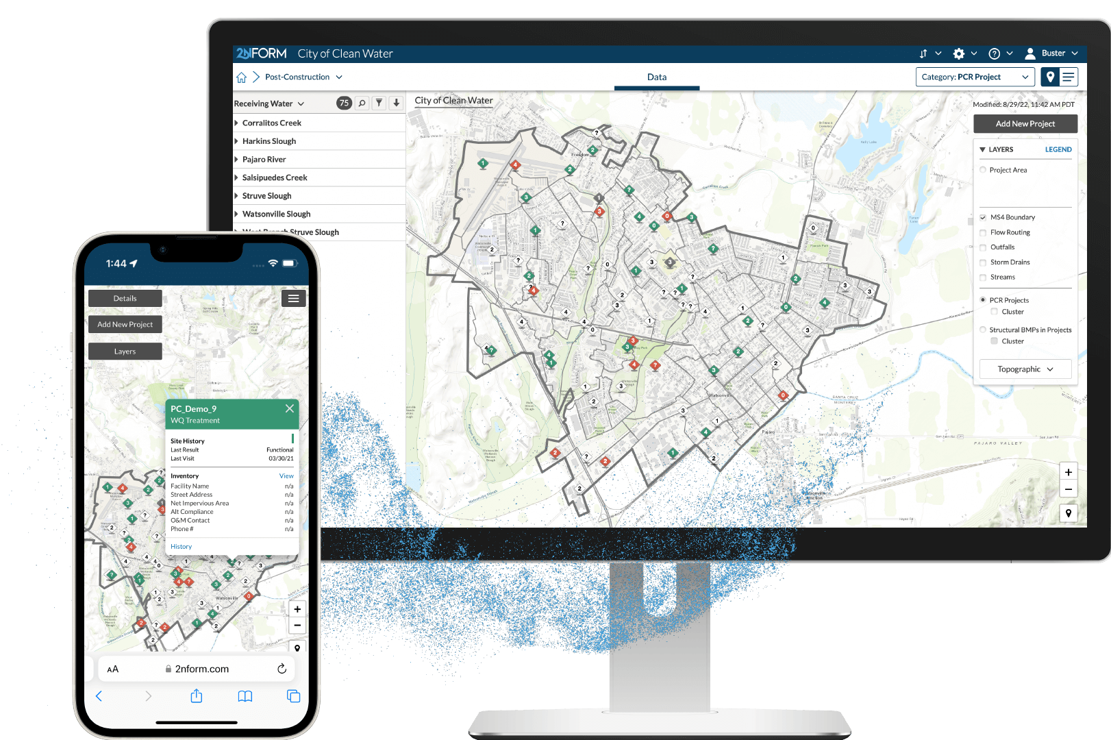
Create a living inventory
Maintain a living inventory of all private stormwater assets, designs, and project details
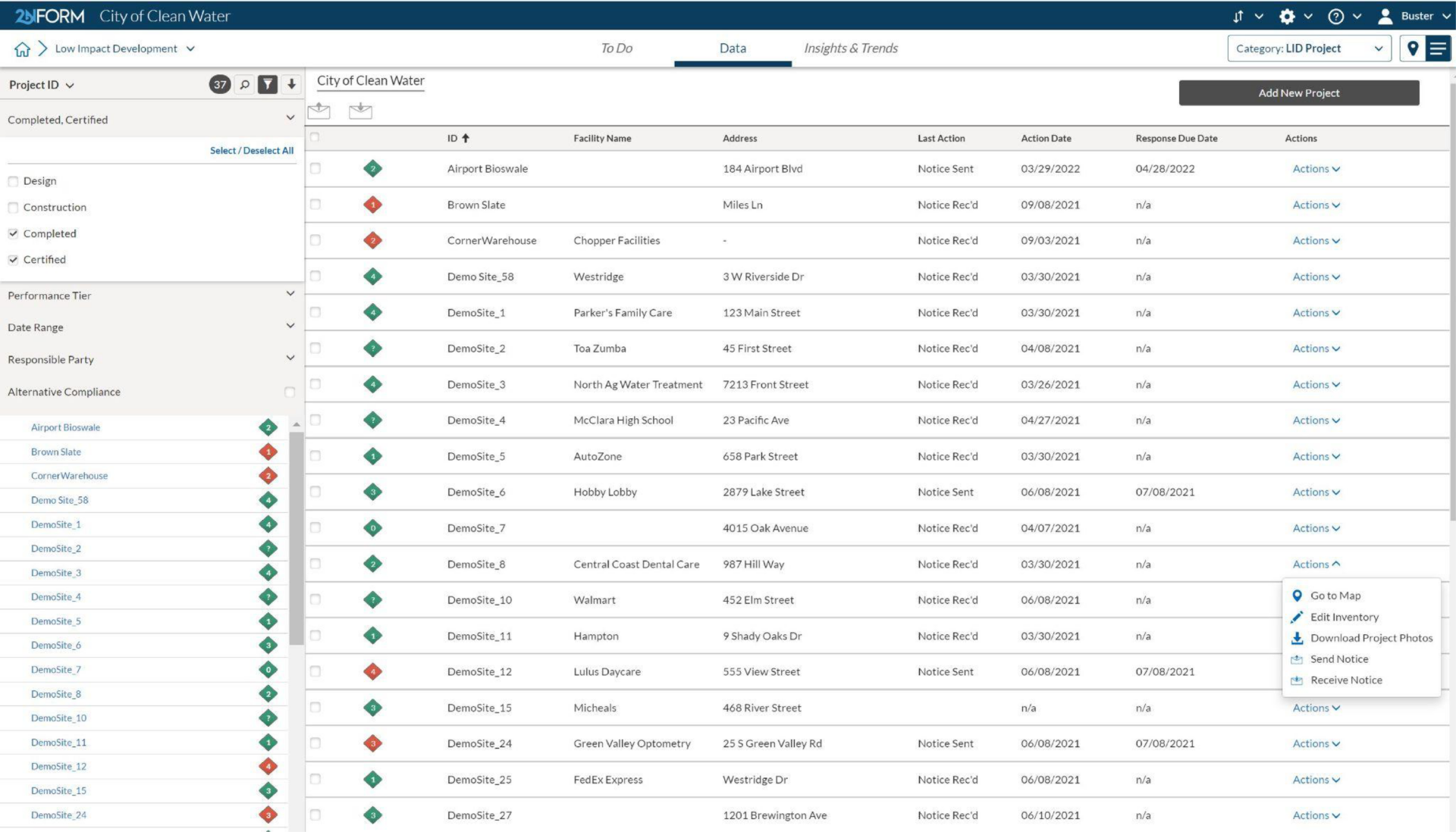
Deliver on intended outcomes
Manage your entire (re)development portfolio as a resource, incorporating low impact development standards to collectively minimize runoff and pollution.
Streamline record management
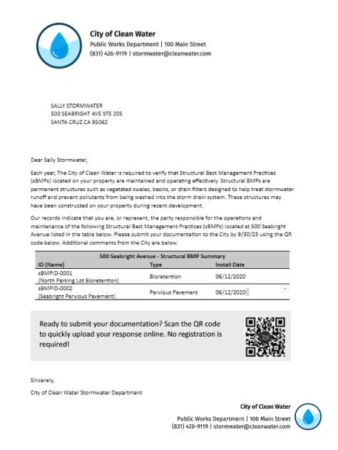
Streamline the process of issuing notices and managing annual self-certification and inspection documentation.
Collaborate with ease
Set automated reminders to issue notices to responsible parties, prompting them to upload their annual maintenance and self-certification documents via the Collaboration Portal.
With 2NFORM Post-Construction, you can effectively manage inspections, documentation, and compliance for all private stormwater infrastructure.

Maintain project records from approval to completion
Ensure all approved site designs are centrally managed and easily accessible.
Provide inspectors with the tools they need to verify required stormwater controls on private projects are built to approved site designs.
Built in Capabilities

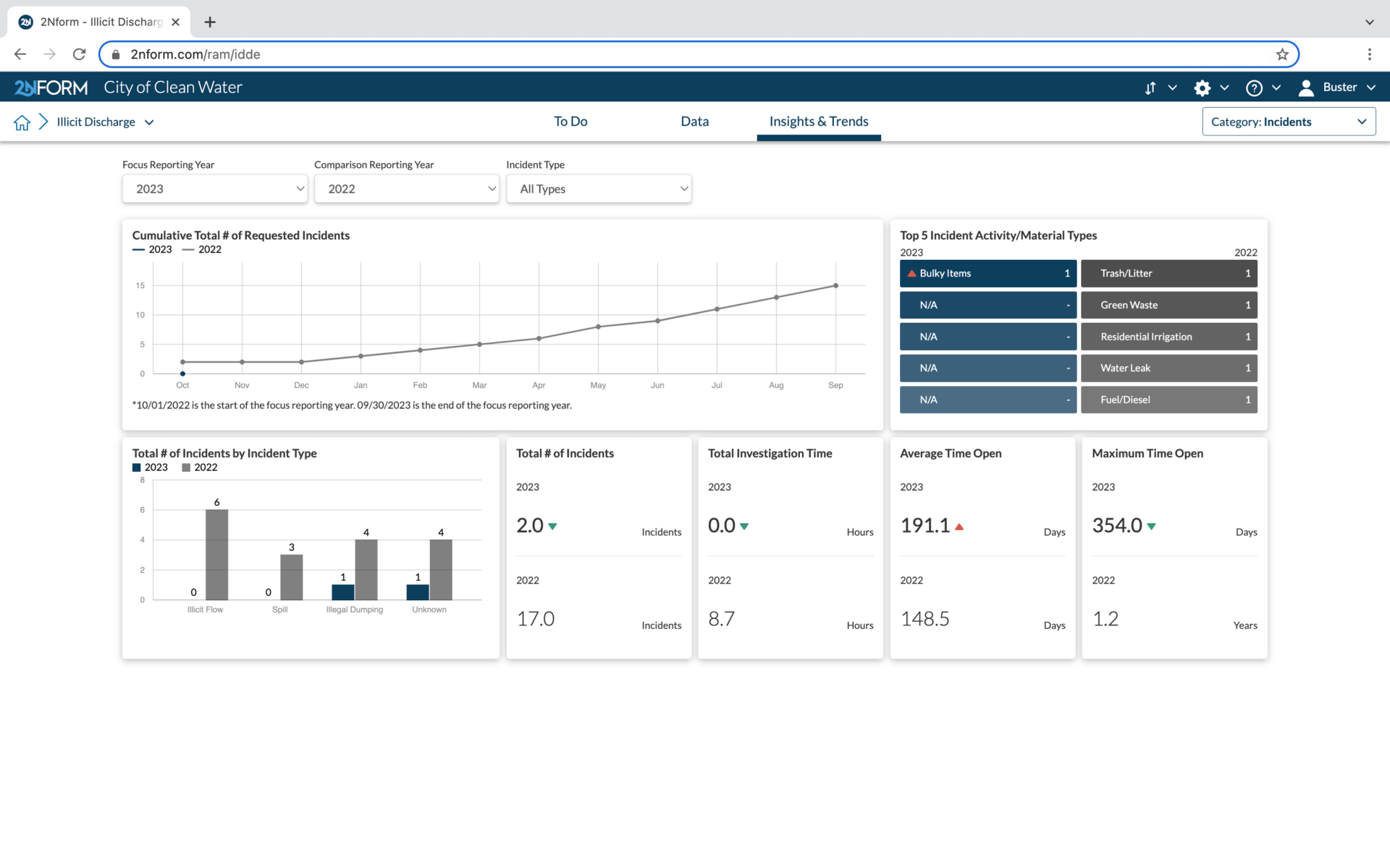
Streamlined compliance reporting

Intuitive problem solving with GIS

Data-driven insights and trends

Smartphones, not clipboards

Schedule and track work
Streamlined compliance reporting
2NFORM streamlines the compilation of your MS4 annual report by summarizing the data your team has collected throughout the year into the relevant section of your permit. The software generates maps, tables and concise narratives populated with program details to summarize program progress and clean water impact of your program efforts.
2NFORM allows you to spend more time on strategic stormwater management and less time reporting to your regulator.
More 2NFORM Modules you may like

Construction Module
Streamline SWPPP compliance with 2NFORM. Manage inspections, erosion controls, and stormwater requirements efficiently for MS4 programs
View module
Let us help you map a better way
Book a personalized demo to see how our products provide the visibility you need to streamline compliance, achieve your goals, and focus your energy on clean waterways.