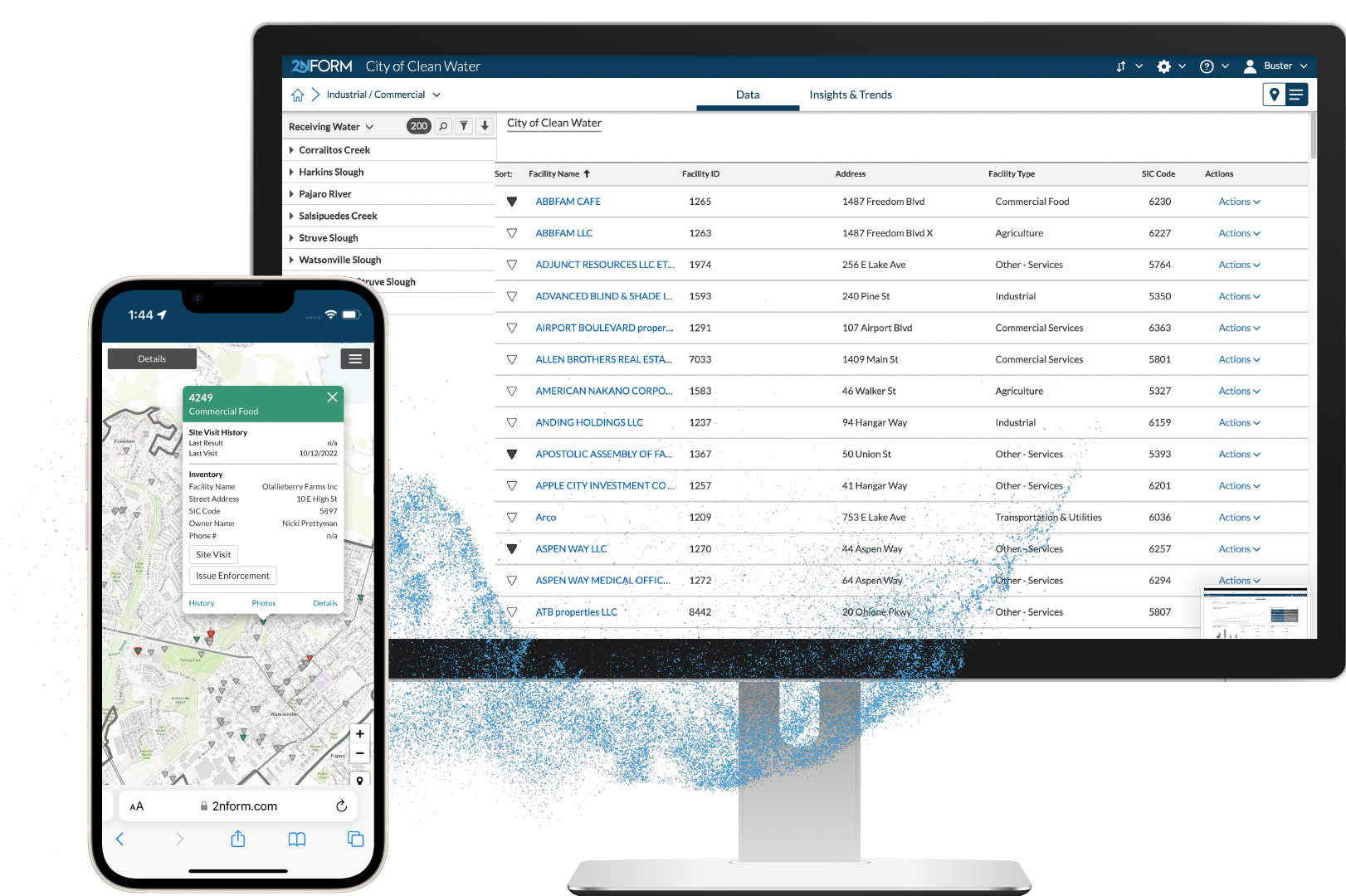
Stay up to date with inspections
Automated workflows with reminders and checks help you stay in compliance.
Track enforcements
Organize enforcement actions using a flexible workflow that adds and stores documentation at every step.
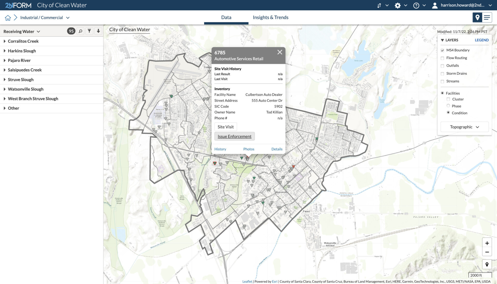
Maintain a living record
Maintain records for current and past inspections, even after businesses close
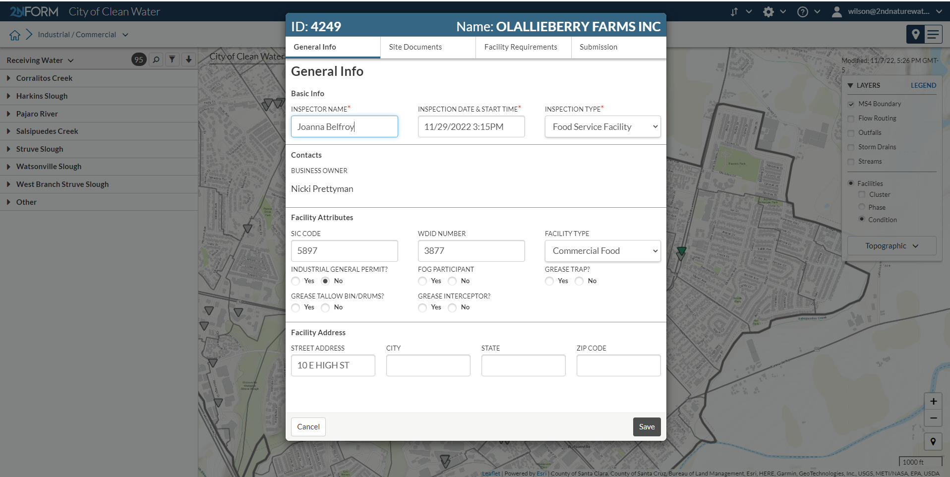
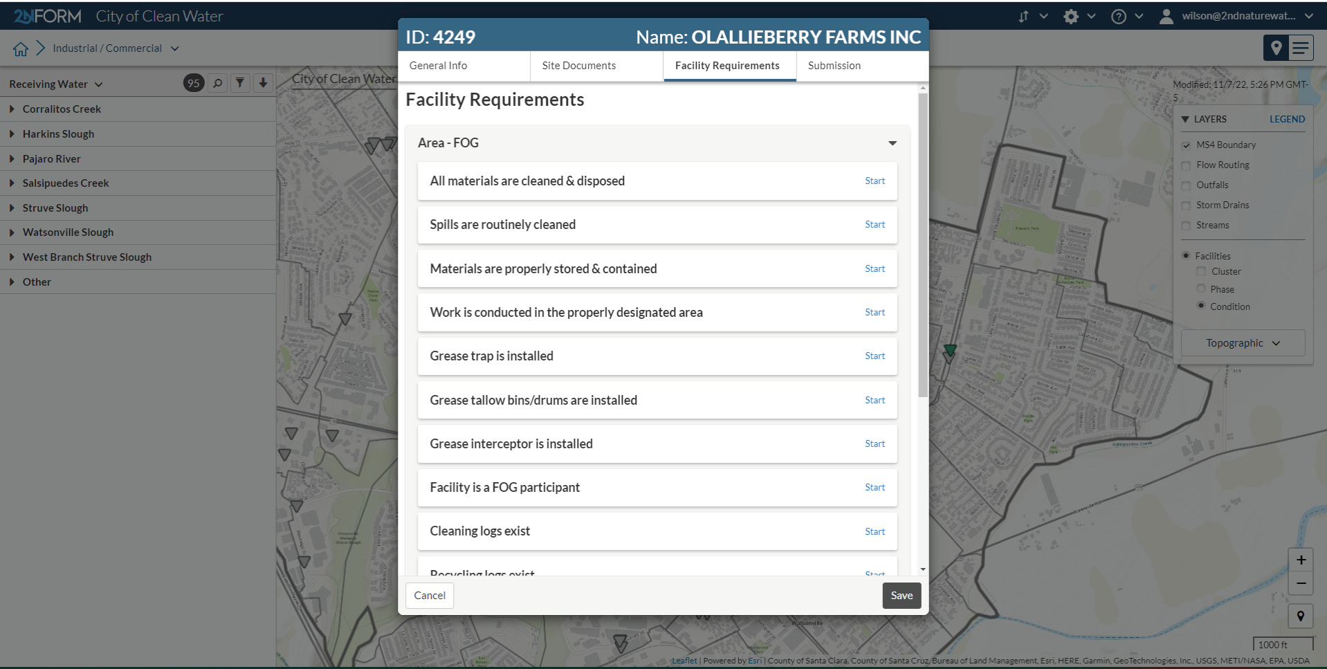
Configure your forms
Help inspectors switch to digital forms with configurable fields and language that makes them comfortable.
Reduce risk
Mitigate the risk of lawsuits with replicable, scientifically defensible inspection processes.
Transform your inspection process
Inspect, correct, and enforce
2NFORM becomes your single source of truth for Industrial / Commercial stormwater requirements.
Inspect sites to confirm best practices are being followed, request corrective actions if a problem is identified, and issue enforcements as needed.
Maintain secure records of every part of the process, stored in the cloud and accessible from anywhere.
Built in Capabilities

Streamlined compliance reporting

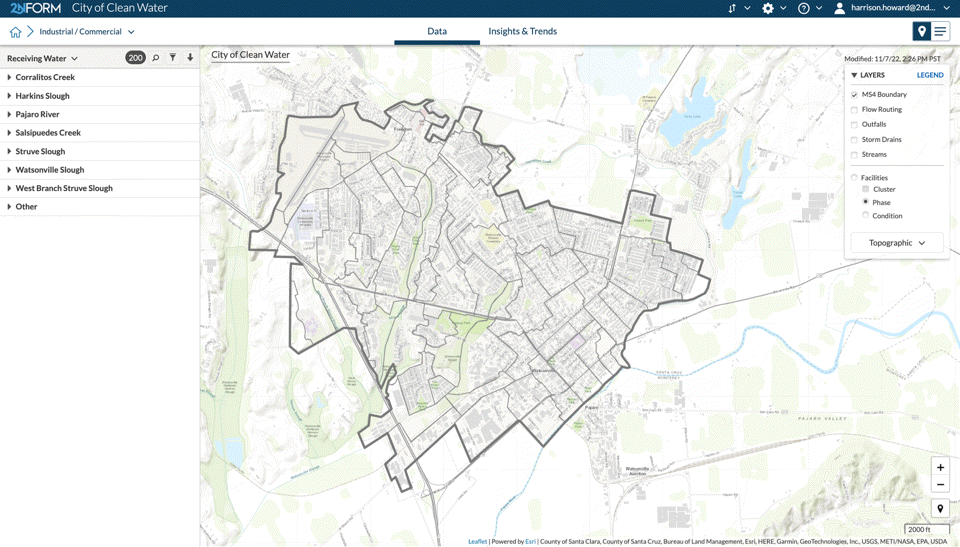
Intuitive problem solving with GIS
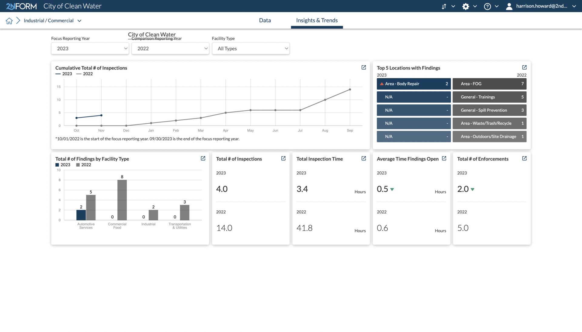
Data-driven insights and trends
Smartphones, not clipboards

Schedule and track work
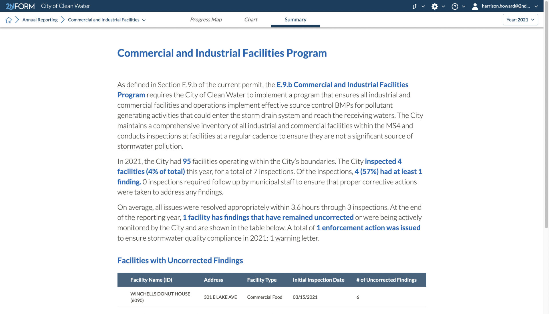
Streamlined compliance reporting
2NFORM streamlines the compilation of your MS4 annual report by summarizing the data your team has collected throughout the year into the relevant section of your permit. The software generates maps, tables and concise narratives populated with program details to summarize program progress and clean water impact of your program efforts.
2NFORM allows you to spend more time on strategic stormwater management and less time reporting to your regulator.
More 2NFORM Modules you may like
Municipal Maintenance Module
Streamline MS4 Good Housekeeping with 2NFORM. Manage assets, track inspections, and automate reporting using GIS for stormwater compliance.
View module
Post-Construction Module
2NFORM simplifies post-construction compliance for MS4s. Manage inspections, document assets, and automate reporting with GIS tools.
View module
Illicit Discharge Module
2NFORM simplifies MS4 IDDE programs. Use GIS mapping, real-time inspections, and automated reporting to detect and eliminate illicit discharges.
View module
Let us help you map a better way
Book a personalized demo to see how our products provide the visibility you need to streamline compliance, achieve your goals, and focus your energy on clean waterways.