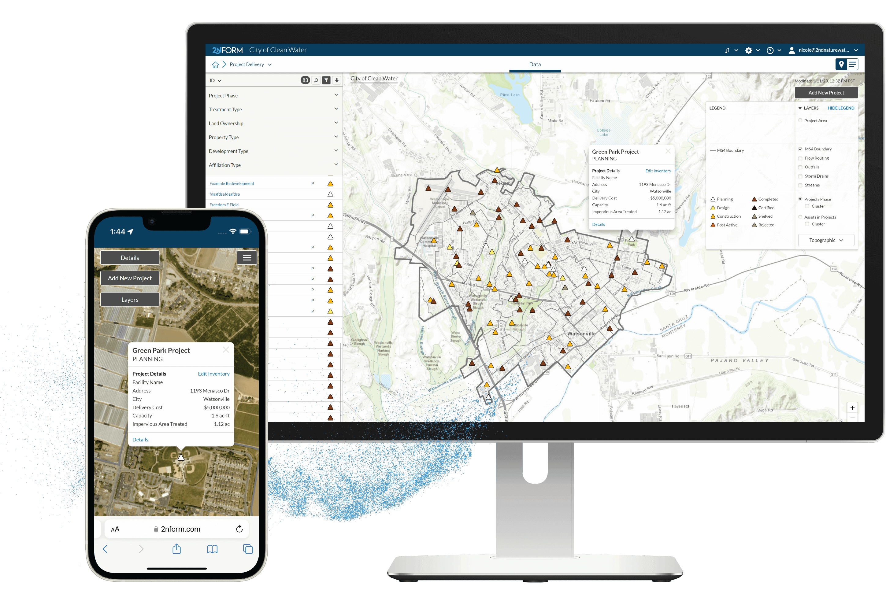
All in one place
A single unified repository for every project.
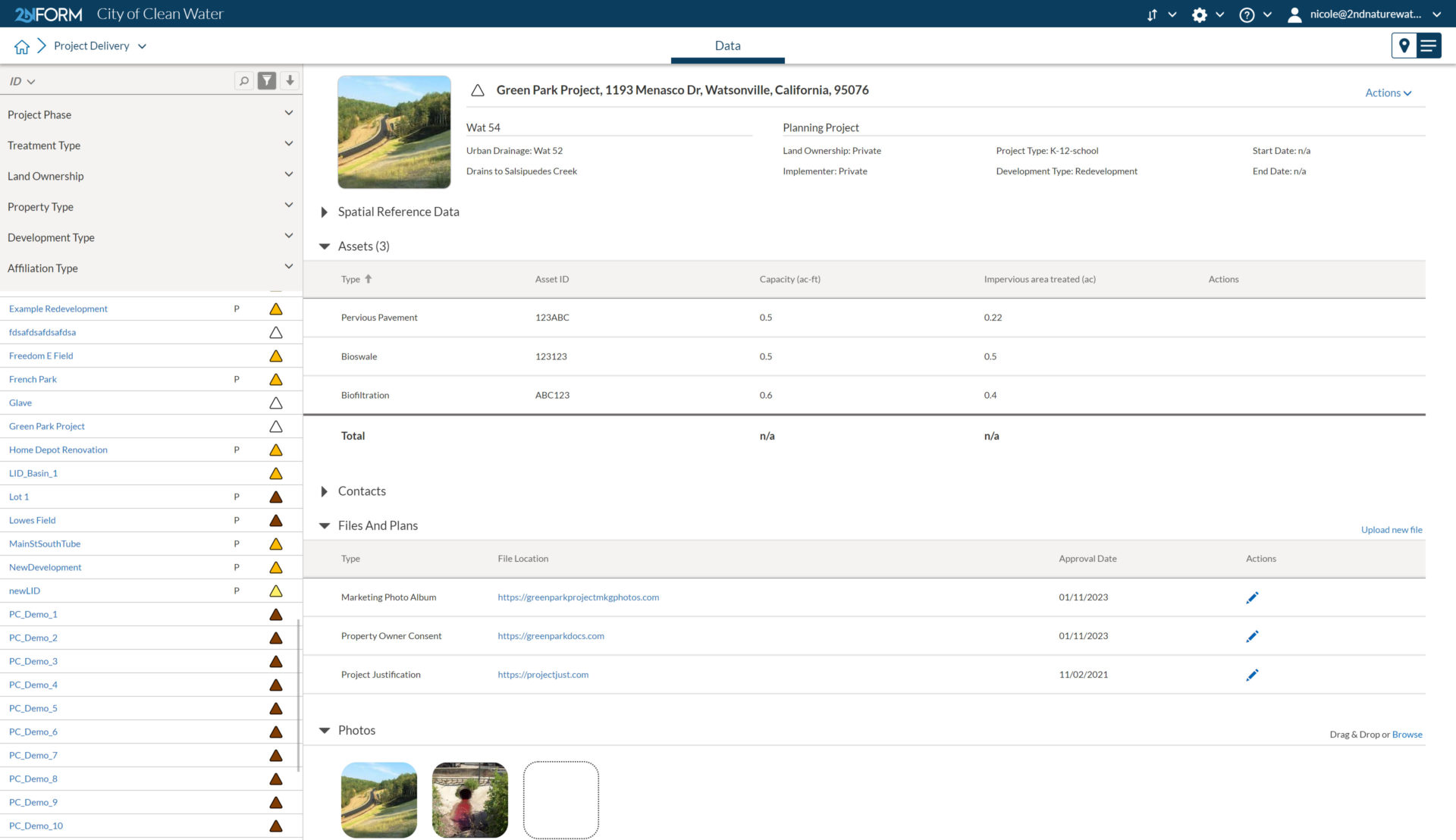
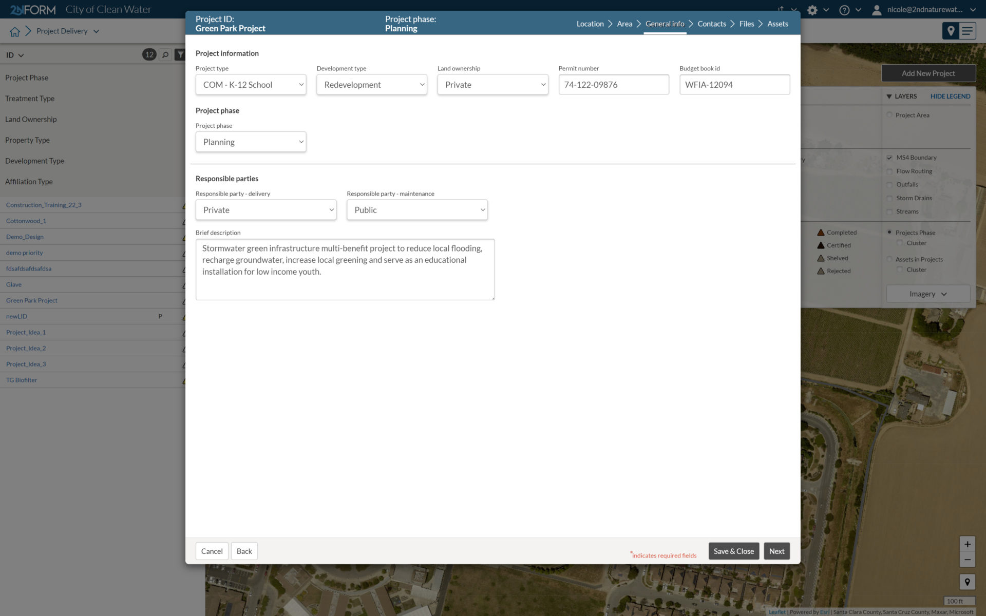
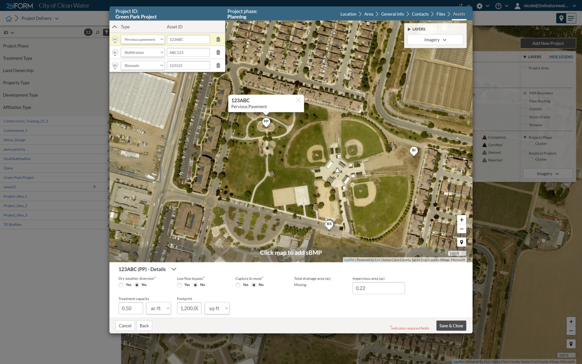
Essential details
Information, plans, and specs you need to deliver a project
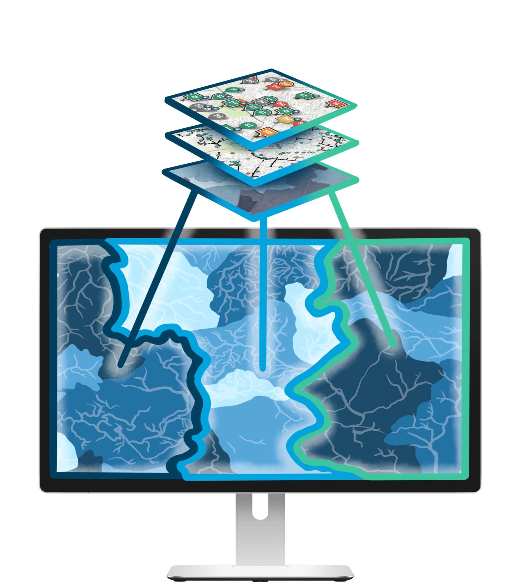
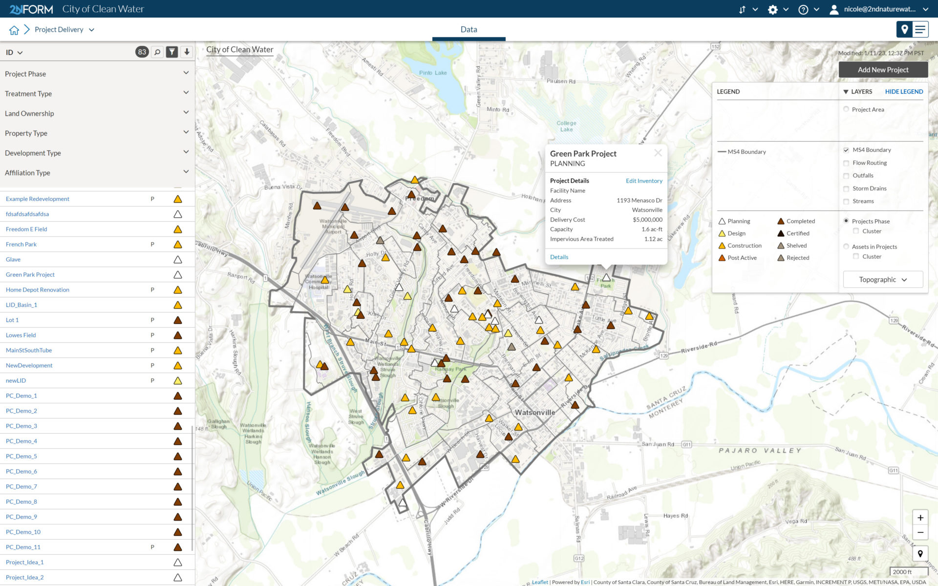
Big picture
Maps make it easy to see how projects fit into your watershed plans.
Rejuvenate
Give old ideas and plans new life.
Engage stakeholders
Draw attention to the possibilities with interactive maps and dashboards.
Manage the complete portfolio of your stormwater projects
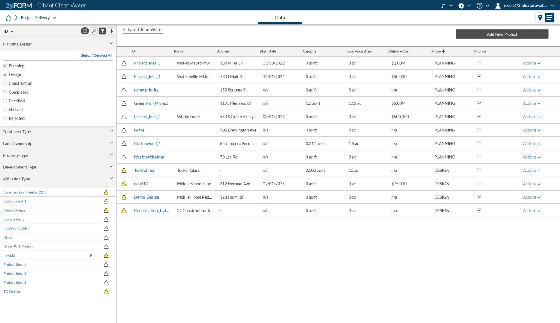
All in one place
Present
Get an update on the location and status of every active project in your portfolio. Dive into the project fact sheet to bring up all essential information about the planned assets and expected benefits to the community.
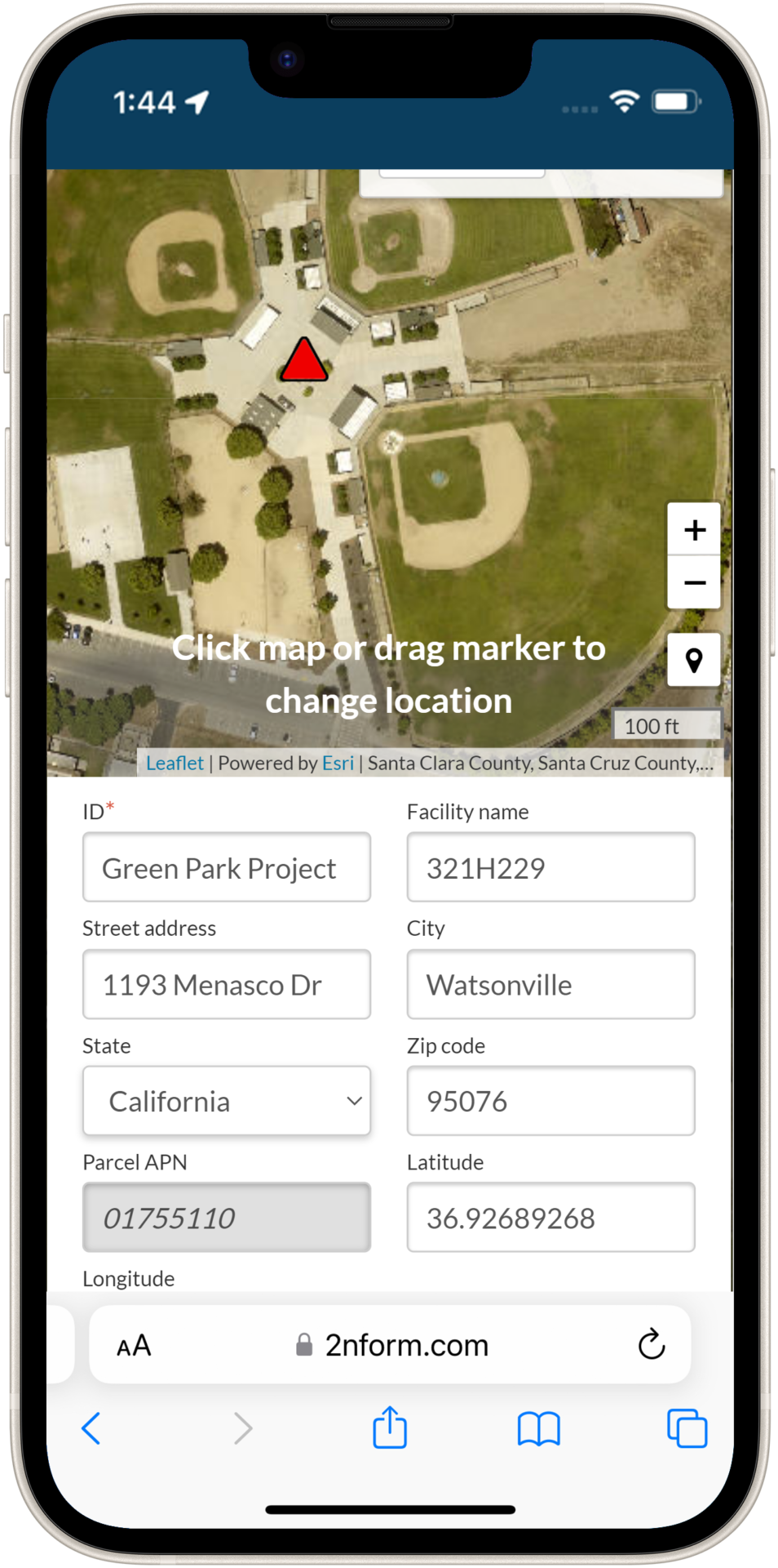
Capture the essential details
Location
Pin every project to the map in the office or the field. Use the latest available imagery to help you identify the exact location of your project.

Built into every module

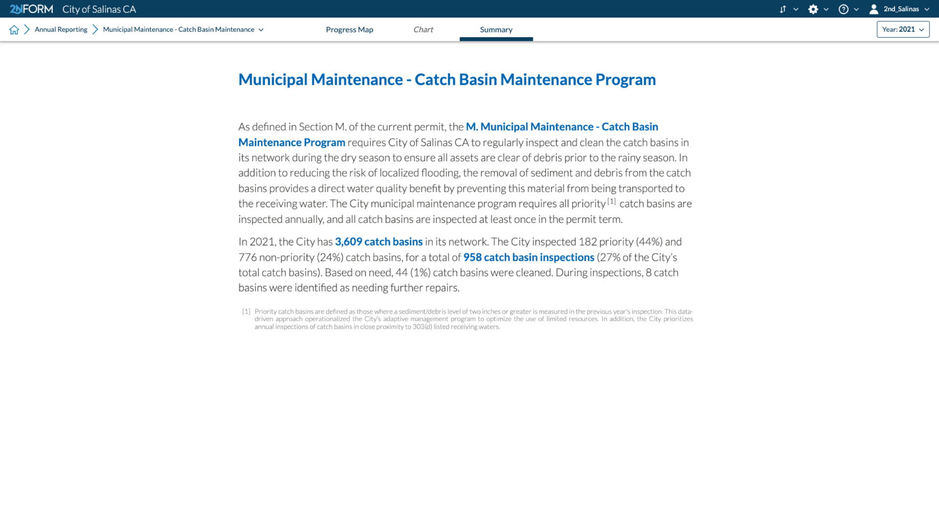
MS4 compliance reporting

Mapping & GIS features
Data-driven insights

Smartphones, not clipboards

Schedule and track Work
MS4 compliance reporting
2NFORM streamlines the compilation of your MS4 annual report by summarizing the data your team has collected throughout the year into the relevant section of your permit. The software generates maps, tables and concise narratives populated with program details to summarize program progress and clean water impact of your program efforts.
2NFORM allows you to spend more time on strategic stormwater management and less time reporting to your regulator.
More 2NFORM Modules you may like


Post-Construction Module
2NFORM simplifies post-construction compliance for MS4s. Manage inspections, document assets, and automate reporting with GIS tools.
View module
Municipal Maintenance Module
Streamline MS4 Good Housekeeping with 2NFORM. Manage assets, track inspections, and automate reporting using GIS for stormwater compliance.
View moduleLet us help you map a better way
Book a personalized discovery call to see how our products provide the visibility you need to streamline compliance, achieve your goals, and focus your energy on clean waterways.