2NFORM: Comprehensive MS4 Compliance and Stormwater Management Software
GIS-Driven
Harness the power of GIS for better asset management, automated workflows, and compliance tracking.
Science-Backed
Data-driven insights optimize stormwater strategies and demonstrate measurable impact.
Modular by Design
Tailor your solution by selecting only the modules you need—no unnecessary costs or complexity.
Simplify Compliance, Save Time
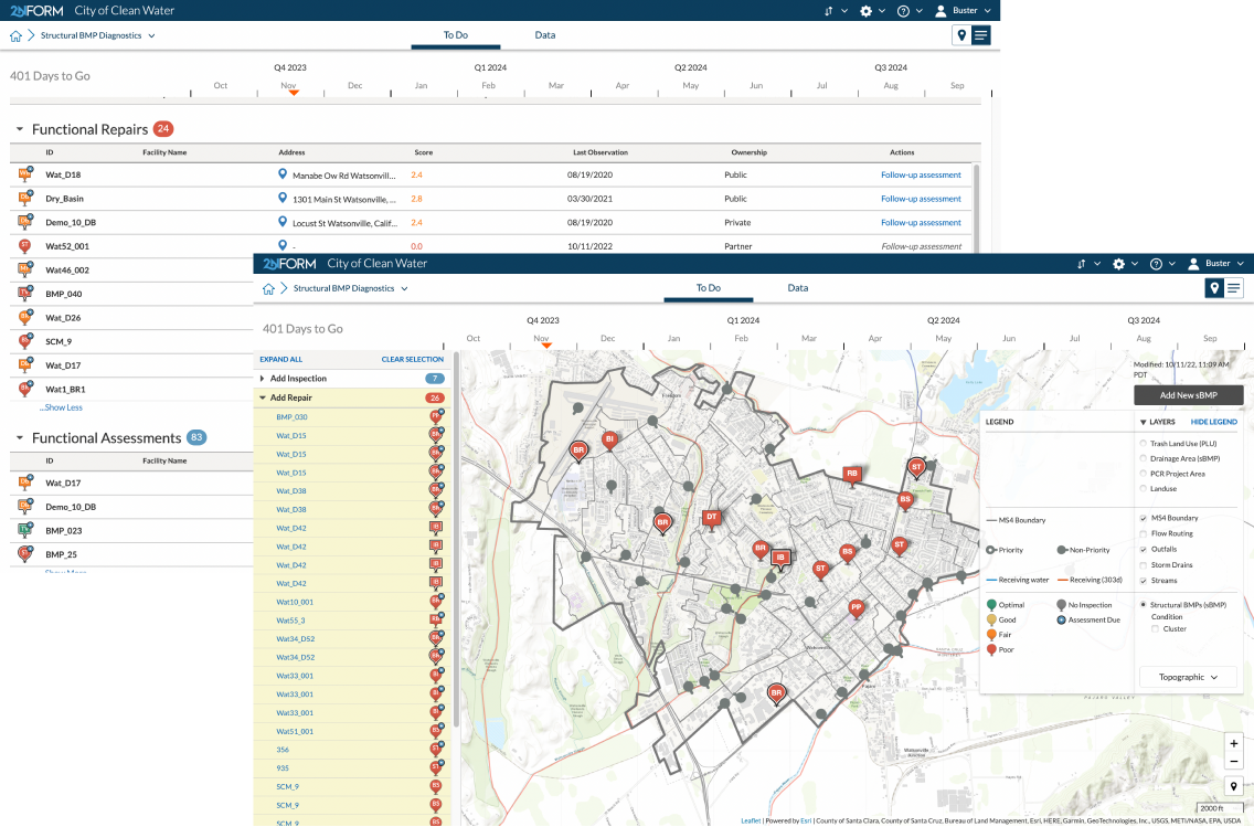
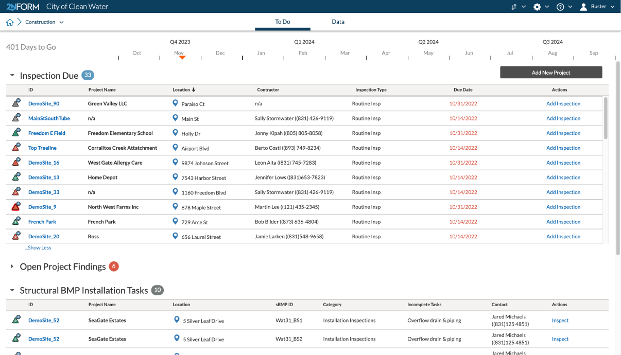
Organize efforts
Track time-sensitive tasks to ensure compliance efforts stay on schedule.
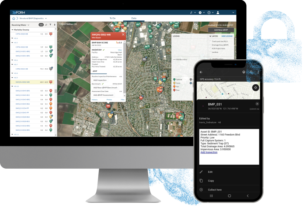
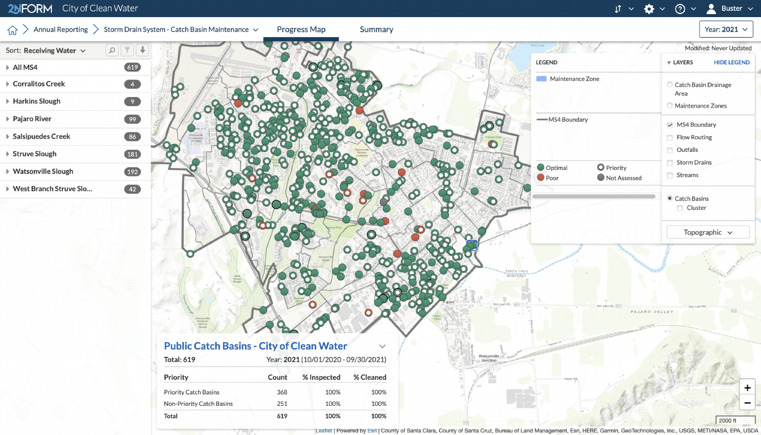
Comprehensive GIS Functionality
Use maps to understand the landscape and communicate where stormwater challenges exist.
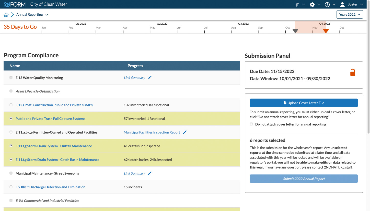
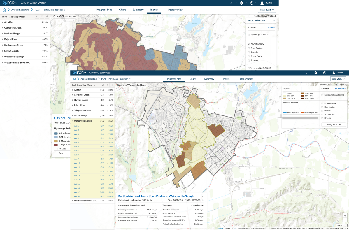
Automated digital reporting
As you do your work, annual compliance reports are automatically generated from the data you collect.
Purpose-built for stormwater managers
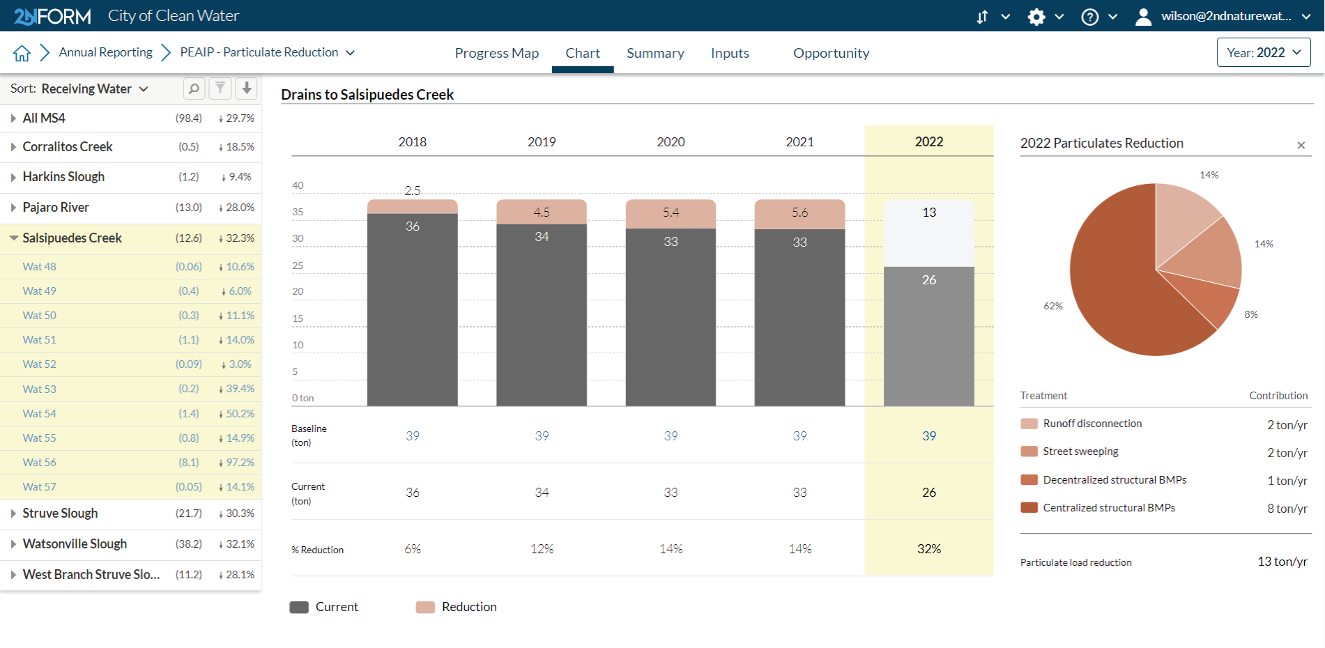
MS4 compliance reporting
Intuitive problem solving with GIS
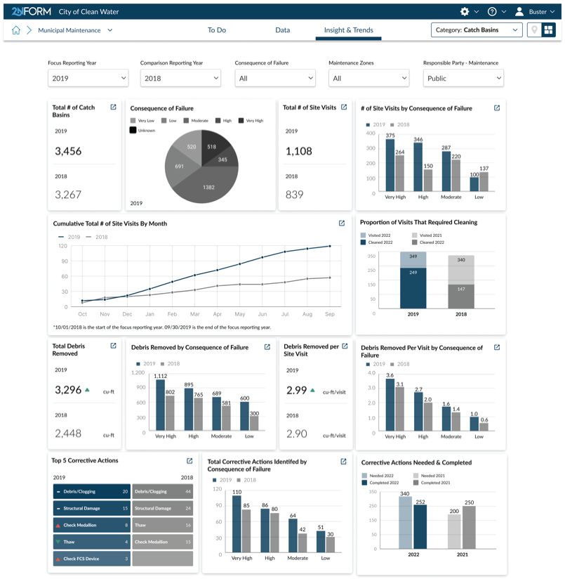
Data-driven insights and trends
Smartphones, not clipboards
Schedule and track work
MS4 compliance reporting
Streamline data wrangling and eliminate the drudgery of annual reporting so you and your team can focus on where to allocate resources most effectively to reduce pollution and flooding.

I can feel confident that we’re using our limited resources in the most effective way possible.”
Learn how Heidi is using 2NFORM to save time and money, while developing a collaborative relationship with her regulator.
Read the case study
Flexible, Scalable Solutions for Every Permittee
With 2NFORM, you only pay for the tools you need. From stormwater inspection software to scenario planning and trash reduction, our modular platform adapts to your unique requirements.
Municipal Maintenance Module
Streamline MS4 Good Housekeeping with 2NFORM. Manage assets, track inspections, and automate reporting using GIS for stormwater compliance.
View module
Industrial/ Commercial Module
2NFORM helps MS4 programs manage industrial and commercial compliance. Automate inspections, track data, and prioritize high-risk sites with GIS
View module
Construction Module
Streamline SWPPP compliance with 2NFORM. Manage inspections, erosion controls, and stormwater requirements efficiently for MS4 programs
View module
Post-Construction Module
2NFORM simplifies post-construction compliance for MS4s. Manage inspections, document assets, and automate reporting with GIS tools.
View module
Illicit Discharge Module
2NFORM simplifies MS4 IDDE programs. Use GIS mapping, real-time inspections, and automated reporting to detect and eliminate illicit discharges.
View module
Public Education & Outreach Module
Make clean stormwater solutions actionable to your community
View module


Project Delivery
Create a digital portfolio of stormwater projects from concept to delivery
View module

Your Guide to Smarter Stormwater Management
Stay informed with expert resources, including whitepapers, blog posts, and customer success stories.
Chart Your Path to Smarter Compliance
Let 2NFORM transform your compliance workflow. Whether you’re managing stormwater inspections, assets, or reporting, our GIS-driven tools adapt to your needs.