Cloud computing has revolutionized how we live and work, from navigating through cities to managing our finances. One prime example of how our lives have changed is Google Maps. We have little need for paper maps and rarely travel beyond our hometowns without the timely prompts from our phones guiding every turn. Thanks to analytic models, cloud computing, and the right data, Google has provided mapping outputs on a scale that was once unimaginable. But it’s not just the familiar mainstays from the tech giants that benefit – the same technologies and innovations powering those tools are leading stormwater management in the same direction.
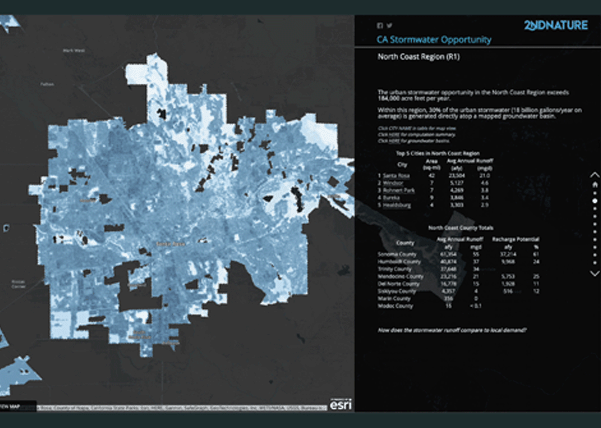
Enter 2NDNATURE, a team of scientists, stormwater modelers, and GIS professionals on a mission to use the latest cloud-based technologies to empower decision makers. This represents an exciting new era in stormwater modeling that parallels recent shifts across other sectors, where advancing technology has made new ways of working, and in that process, automating many of the tasks that used to be the exclusive domain of experts. Harnessing the power of cloud computing, 2NDNATURE created a stormwater model that faithfully represents the spatial patterns of the urban landscape at high resolution to estimate runoff impacts on local waterways reliably. The model has been peer-reviewed in multiple journal publications, provides a spatially explicit tracking of stormwater program actions on the urban landscape, and is directly verifiable by monitoring at local outfalls and streams.
Stormwater programs still need models because water quality measurements are expensive, and we can’t measure everywhere we should to make wise decisions about stormwater planning. Models can comprehensively estimate factors such as runoff generation rates, pollutant loading, BMP performance, infrastructure conditions, or street sweeping effectiveness across an entire city. They often represent our best understanding of how the system functions. Measurements here and there are valuable for identifying problems and verifying changes, but since they only provide us fleeting glimpses of the state of stormwater systems at specific locations, we must rely on the models to fill in the gaps.
There is a well-known aphorism from the renowned statistician George Box: “All models are wrong, but some are useful,” which rings as true today as it did decades ago. Stormwater models should predict how close we are to water quality goals and clarify the relationships between stormwater management actions and expected water quality improvements. Stormwater modeling knowledge and methods have become widely accessible, and cloud computing has made it automatable so that using models to identify opportunities or estimate water quality benefits requires far less specialist knowledge than it did in the past.
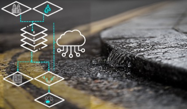
The ability to update model inputs quickly and from anywhere is a tremendous advantage of cloud-based stormwater modeling since it is the local stormwater manager who must collaborate with their municipal peers to optimize street sweeping routes to protect water quality, assess stormwater control measures to track performance, conduct outfall inspections, and site new green infrastructure. Modeling to support stormwater program planning and reporting can be updated as the quality of the input data is refined over time. By connecting the day-to-day stormwater program data as inputs to a municipal stormwater runoff and pollutant load reduction model, the critical information to constrain model behavior ensures the model outputs approximate current conditions. Rapid updating of these inputs means that a stormwater manager can also test different planning scenarios in only minutes. With new tools such as these in the hands of more stormwater managers, we can expect to see more strategic and informed investments that will reduce local flooding, curb urban runoff pollution, and build more resilient communities.
To sum up, it is now clear that cloud-based technology is changing the landscape of stormwater modeling by making it more accessible to inform better stormwater management decisions. The ability to make data-driven decisions in moments rather than months is a significant advancement that allows for more strategic stormwater program planning, ultimately leading to better water quality outcomes.