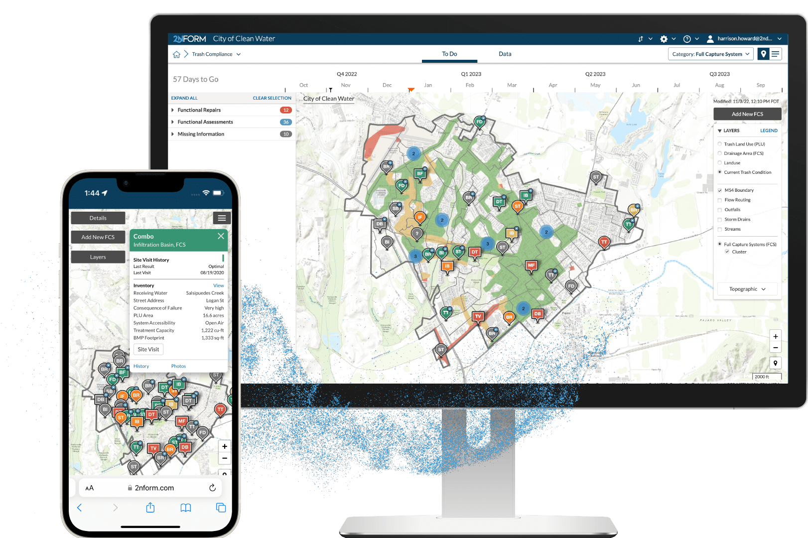
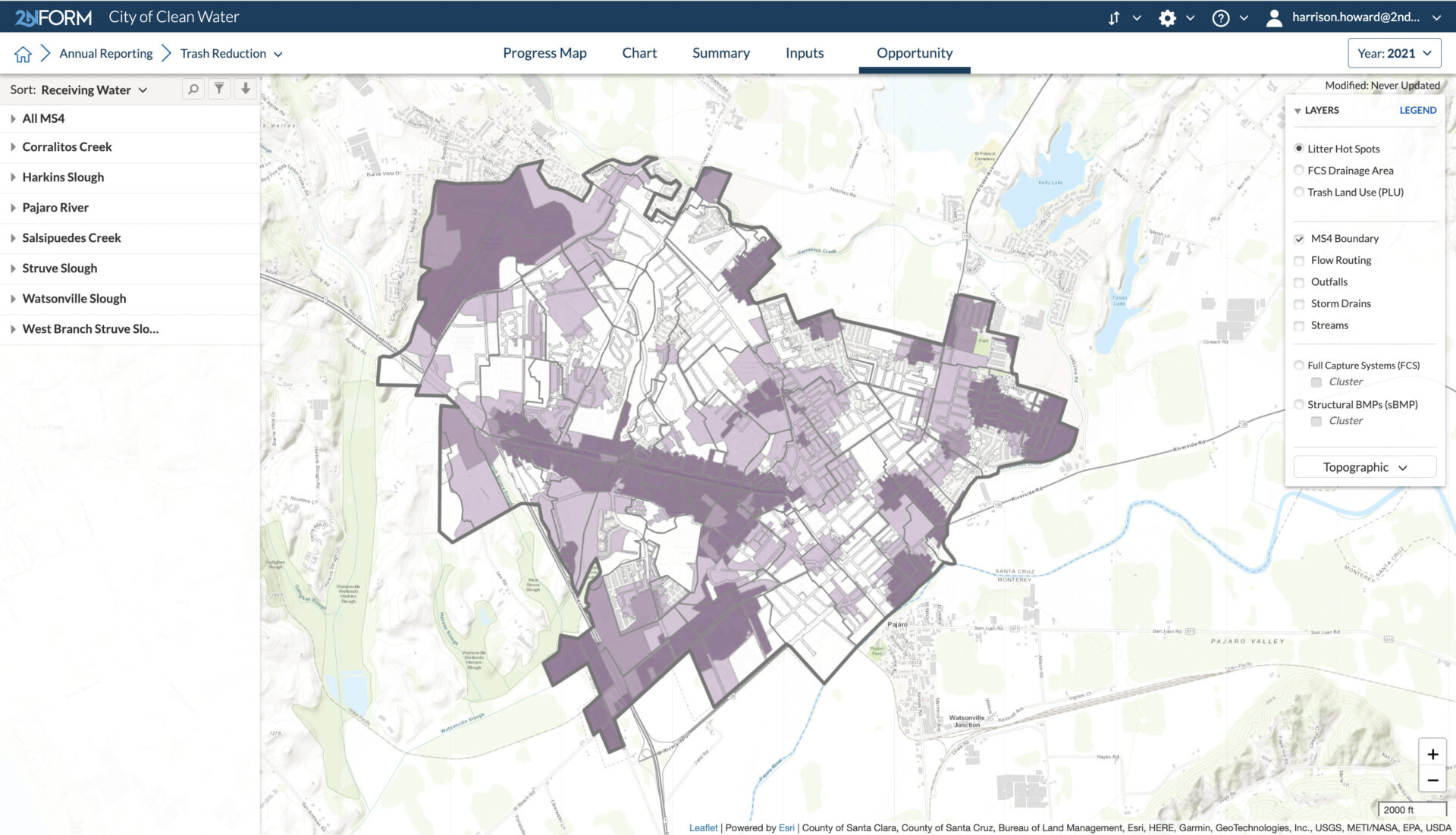
2NFORM Module

Trash Compliance

Achieve your stormwater trash reduction goals

Generate litter distribution maps that help you prioritize trash control strategies and quantify the effectiveness of investments from street sweeping to structural trash capture devices over time.

Conceptual Icon

Delineate your trash prone areas

Combine your GIS land use map with local knowledge to painlessly develop your initial delineation of litter prone areas.

Conceptual Icon

Implement visual trash surveys

Use a phone to capture visual observations in the time it takes you to drive litter-prone areas.

Conceptual Icon

Analytics turn observations into knowledge

Adaptive algorithms transform visual surveys into an accurate map that highlights the density of trash along the roadside.
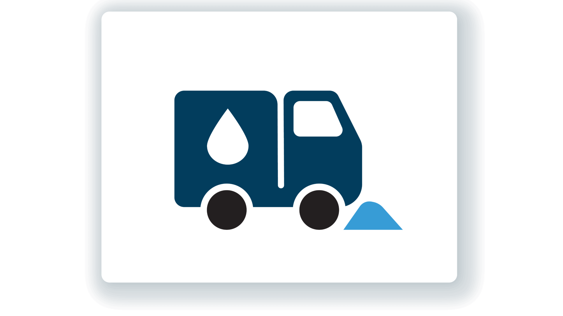
Conceptual Icon

Avoid maintenance headaches

Know with confidence how well your structural trash capture controls are working, so you can anticipate issues and direct your efforts effectively.

Conceptual Icon

Monitor progress and achieve your goals

Closely monitor and transparently demonstrate your efforts to eliminate litter in your stormwater and clean your waterways.

Quantify and visualize trash hotspots
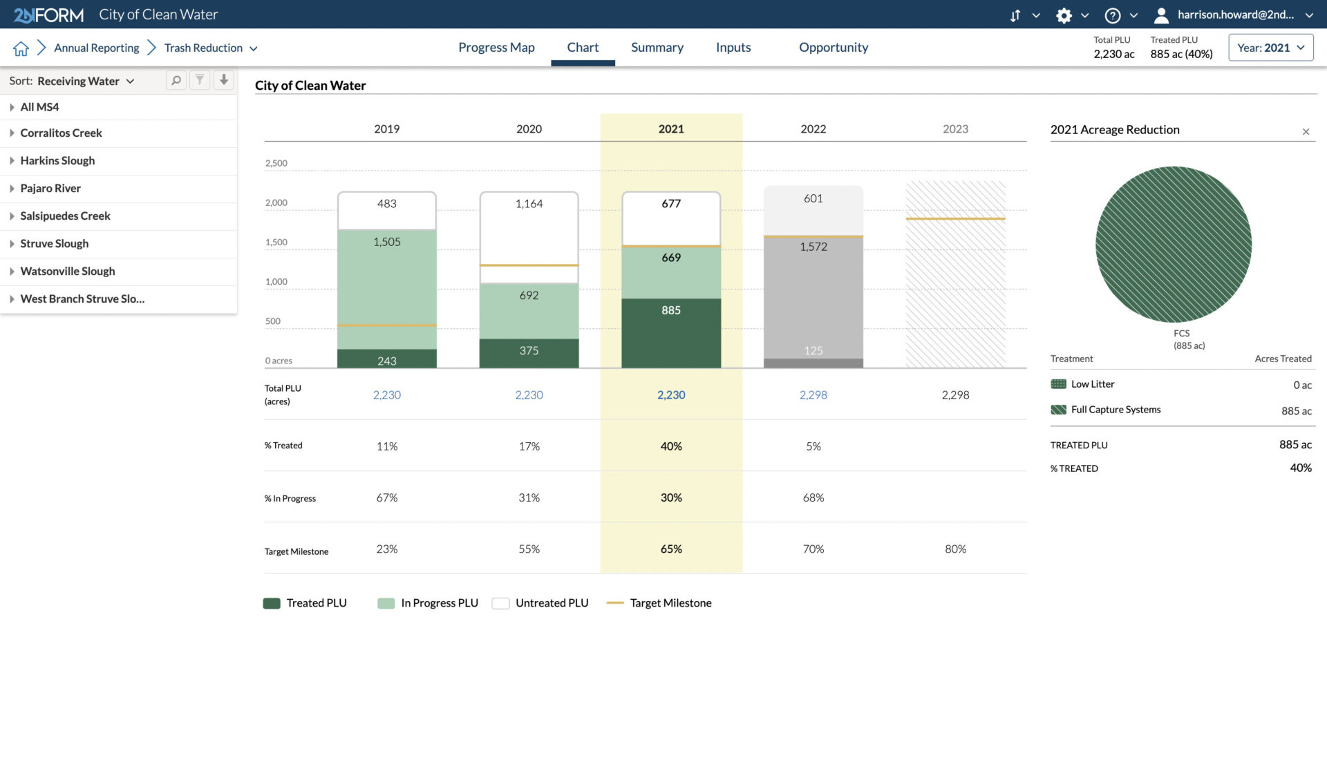
2NFORM in action

How Watsonville, CA is Getting to ‘Zero Trash Down the Drain’

View blog

We Can Stop Trash From Going Into the Oceans. Here’s How.

View blog

The Transformative Power of Applying Geographic Information Systems (GIS) to Stormwater

View blog

Built in Capabilities

Streamlined compliance reporting

Intuitive problem solving with GIS

Data-driven insights and trends

Smartphones, not clipboards

Schedule and track work

Streamlined compliance reporting

2NFORM streamlines the compilation of your MS4 annual report by summarizing the data your team has collected throughout the year into the relevant section of your permit. The software generates maps, tables and concise narratives populated with program details to summarize program progress and clean water impact of your program efforts.


2NFORM allows you to spend more time on strategic stormwater management and  less time reporting to your regulator.

2NFORM stormwater compliance software inserts your own numbers into a narrative summary for MS4 annual reporting
2NFORM Works In Tandem with ArcGIS to Unlock Endless Possibilities

Better together

2NFORM & ArcGIS

Use ArcGIS with 2NFORM to accelerate your journey toward less polluted waterways, less flooding, and more resilient stormwater management. 

Leverage the breadth of ArcGIS products to make the most of your stormwater data. Use ArcGIS Field Maps to display and collect information. ArcGIS Dashboards let you monitor and share stormwater information. With ArcGIS Hub Premium you can inform and collaborate with stakeholders and the community. The possibilities are endless. 

More 2NFORM Modules you may like

2NFORM Municipal Maintenance module icon

Municipal Maintenance Module

Keep your house in order by inventorying assets and optimizing operations

View module
2NFORM Structural BMP Diagnostics module icon

Structural BMP Diagnostics Module

Inventory and monitor public and private sBMPs

View module
2NFORM Illicit Discharge module icon

Illicit Discharge Module

Track non storm-related flows in the urban landscape

View module
2NFORM Public Education & Outreach module icon

Public Education & Outreach Module

Make clean stormwater solutions actionable to your community

View module

Let us help you map a better way

Book a personalized demo to see how our products provide the visibility you need to streamline compliance, achieve your goals, and focus your energy on clean waterways.