Webinar
GIS Strategies for Stormwater Management
Brought to you by Esri & 2NDNATURE
part 1 of 6 | Develop an effective system to inventory and manage your stormwater assets
part 2 of 6 | Modernize how you inspect assets and assess functional condition
part 3 of 6 | The City of Martinsburg, West Virginia A small town's approach to stormwater management with GIS
part 4 of 6 | Esri Feature Adam Carnow from Esri Talks about Data Fueled vs Data Driven
part 5 of 6 | Monitor program effectiveness with maps and dashboards aligned to MS4 KPIs
part 6 of 6 | Engage the public and stakeholders with a compelling story and website
Up Next
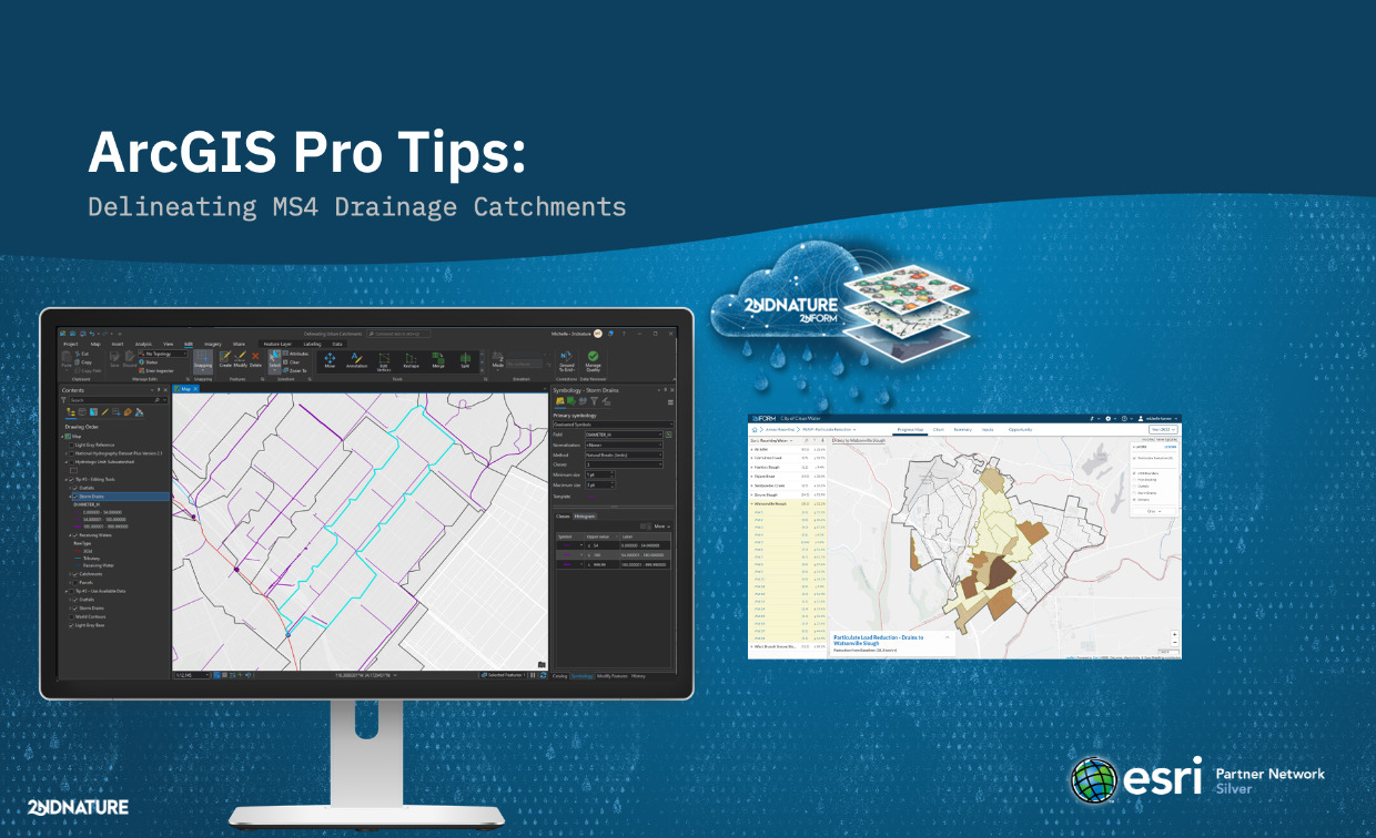
Webinar
ArcGIS Pro MS4 Drainage Catchments: Expert Delineation Tips
In this webinar, Josh and Michelle share their favorite best practices for using Esri's ArcGIS Pro to delineate urban catchments.
Watch Video