Small town Elsmere, DE has the same MS4 compliance responsibilities as any city — but they don’t have a stormwater manager or any technical staff. Town Clerk Diana Reed turned to intelligent stormwater software platform 2NFORM to help her manage Elsmere’s stormwater program. She appreciates the technical expertise and analytics built into the software, and she loves how well it fits into her budget.
THE CLIENT
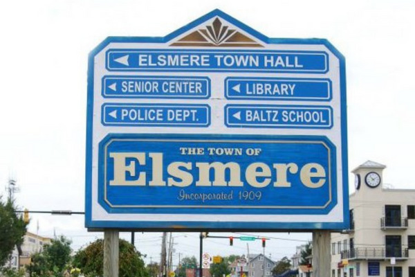
Elsmere, DE
Diana Reed, MMC, Town Clerk for Elsmere, DE
More than 6,000 people live in the single square mile that is Elsmere, DE. Tucked into the Wilmington suburbs in northern Delaware, the densely populated town and its creeks are in the Christina River Watershed, which drains into the highly impaired Delaware River. Elsmere is an MS4 co-permittee with other small towns and with New Castle County and the Delaware Department of Transportation, which are the principal permittees.
THE CHALLENGE
Small Town, Big Stormwater Needs
In the small town of Elsmere, DE, Town Clerk Diana Reed has many responsibilities. She is one of three members of the Administration department who oversee day-to-day town operations, including stormwater management. “Over a year, about 20% of my time is spent on stormwater,” Diana says. “Of course, over the first couple of years, getting into compliance, that number was a lot higher.”
Elsmere doesn’t have its own MS4 permit. Instead, it is a co-permittee with the New Castle County and the Delaware Department of Transportation, along with other nearby towns. But that doesn’t mean that there’s any less work to do to stay in compliance with that permit. “We’re a small town with the same responsibilities of any large town or city,” Diana says. “Within the town limits, we have the exact same responsibilities as the state and the county.”
What Elsmere doesn’t have is a lot of staff or resources. “Technical expertise, we don’t have,” Diana says. “We don’t have stormwater engineers or staff to do technical things like getting a separate permit. We have no GIS data of our own; we rely on New Castle County for GIS data.”
Yavapai County, AZ has to manage stormwater carefully to mitigate flood risks
Read the profileDiana needed an affordable tool that could organize Elsmere’s part in complying with their shared MS4 permit. And she wanted help with the technical and scientific elements of stormwater management that she didn’t have the expertise to handle herself.
OUR SOLUTION
“The funny thing is, we weren’t even looking for a software solution,” Diana says. She learned about 2NDNATURE and 2NFORM from a meeting of the State of Delaware Stormwater Consortium, when another client, the City of Dover, shared their positive experience with the software. 2NFORM is a robust software platform that provides intelligent stormwater management and compliance, purpose-built by stormwater scientists and experts to meet the needs of busy MS4 permit holders.
Diana liked what she saw: “I realized 2NFORM would give us a lot of capabilities we didn’t have, at an affordable cost.”
Those capabilities include a central, cloud-based repository for all of their stormwater data, both current and historic; ArcGIS-based interactive maps that make understanding and organizing a stormwater program much more intuitive; mobile tools to categorize, inspect, and maintain structural stormwater assets; analytics that connect trash cleanup efforts with the amount of pollution going into waterways; and an improved annual report. Diana is a fan of all of them.
Mobile Tools Feed into Secure, Centralized Data
In Elsmere, stormwater management is a group sport. “Public Works does drain inspections and catch basin inspections, things like that,” Diana says. “And a third party engineering firm does our IDDE investigations and dry weather outfall screening.” They all enter data directly into 2NFORM, where it’s securely stored in the cloud and accessible from anywhere. “It’s mobile friendly,” Diana says happily. “They’re out there doing inspections on their iPhones.”
Diana and these field workers use 2NFORM’s interactive maps, built on Esri’s ArcGIS, to literally see the stormwater program in action. This data visualization is powerful, and the intuitive interface means that Diana now has access to GIS-enabled insights, without having a GIS person on staff.
Built-In Analytics Provide Technical Expertise
Diana also appreciates the categorization tools that 2NFORM includes, so Elsmere could get their SBMP data organized. “We were missing important information like sBMP size — basic stuff like length, width, depth. We had geospatial information but not construction information or condition.” 2NFORM walks users through the process of categorizing their structural stormwater assets into a short list of basic types, and then users can add additional information about the asset.
Now that all of Elsmere’s sBMPs are entered into 2NFORM, Diana can see each one on a map, including its type, condition, pictures, a history of recent inspections, and when it’s likely to need maintenance. This helps her prioritize and schedule repairs and maintenance on these expensive but important town assets: a small investment with a big payoff in functionality. “It’s a big upgrade in functionality from our old spreadsheet,” Diana says.
Diana really appreciates the built-in analytics that 2NFORM provides. “Before, we could tell the tonnage of street sweeping waste that we were collecting,” Diana says. “But we didn’t have the expertise to connect it to the amount of pollution going into the waterways.” The analytics in 2NFORM are based on current peer-reviewed science, and they are designed to give scientific insights to busy people like Diana, who may not have technical training but need to quantify the effectiveness of their program. “Having 2NFORM take the data that we have and give it the engineering twist that we don’t have has been great,” Diana says.
Improved MS4 Annual Reports
When annual report time comes around, Diana feels a little smug: “Compared to other communities — not DOT or the County, who have dedicated stormwater departments, but other small towns like us — we’re doing better at meeting permit requirements and documentation requirements.”
Because of the co-permit, Elsmere turns in its data and narratives to the County, which assembles all of the co-permittees’ information into a single annual report. “Historically, we got our biggest comments on the narrative portion of the report,” Diana says. That’s why she likes the executive summary that 2NFORM generates, taking Elsmere’s data and plugging it into a template that turns it into a customized technical write up: “Our report looks better than it ever has. Not that it looked awful before. But if you’re not an engineer, how do you give a technical report?” With 2NFORM, that’s how.
And Diana appreciates the time savings. “Compared to a few years ago, when I took over, pulling together the data for our annual report is now a lot less time consuming,” Diana says. She can use the time she once spent organizing data doing the million other things that Elsmere needs from her.
Big Return on Investment for a Small Town
“Big cities can afford a fancy stormwater program,” Diana says. “But for small towns with smaller budgets and fewer resources, affordable software like 2NFORM is huge. Software helps with the technical side when you don’t have a person to do it.”
Diana absolutely sees a strong return on their investment in 2NFORM: “The affordability and return for the dollars is very high.”
Most of all, she appreciates the peace of mind that 2NFORM gives her. With this powerful tool, she can be confident that she’s doing her best for Elsmere’s waterways and using her time and Elsmere’s resources effectively.